YouTube
New4:45
Dev Report, October 2026: We rebuilt the map in 3D
What changed in the month since the teaser, in five chapters. Subtitles in English, Japanese, Chinese and Korean.


Footage of the game in development; not representative of final quality.
Dev Report, October 2026 is outA town-building simulationIn development
From a small town to the country's other centre.
01The game
The game is set in San'in, on the shore of Lake Nakaumi. The map is built from the real lie of the land around Honjo in Matsue, so the rice fields, the villages and the lakeside road start out as they really are. Draw the zones, and homes, shops and factories go up on their own. As mayor you build roads, railways and the port, run the town and its budget through ordinances and town hall departments, merge with the towns next door and work towards becoming a city. The seasons turn, and typhoons and earthquakes come too.
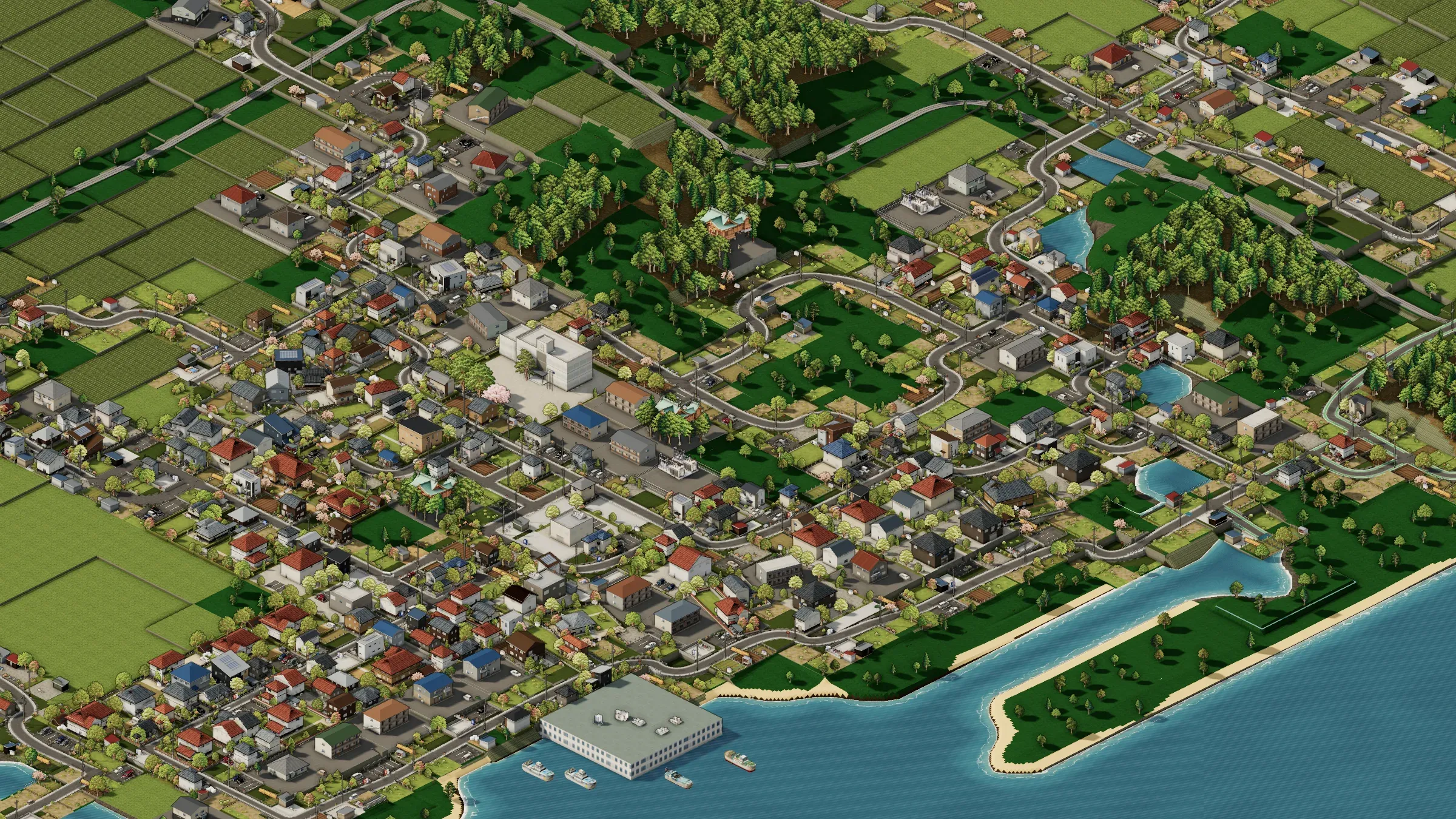
At the end of October 2026 the map was rebuilt from 2D into 3D. Roads can now run at any angle, and every house is put together in 3D. The detail isn't yet up to what the 2D version had; it's being polished now.
02Videos
New4:45
What changed in the month since the teaser, in five chapters. Subtitles in English, Japanese, Chinese and Korean.
2:08
One run of the game, from a town of 1,200 to a city of two million, filmed while the map was still 2D; the growth scenes are sped up for filming.
03Highlights
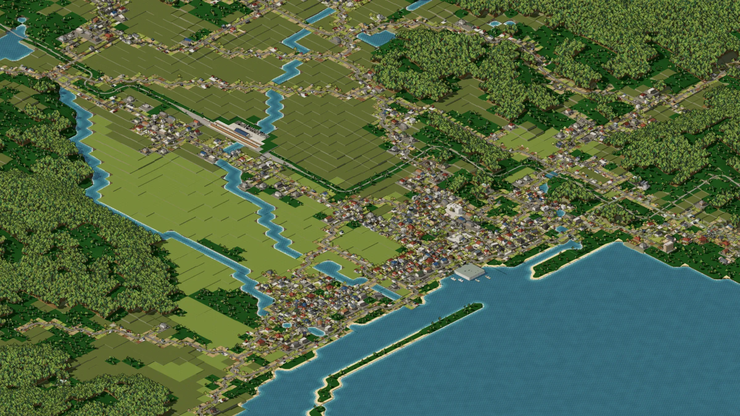 REAL TERRAINFrom the real landIt starts from the real land around Lake Nakaumi and Honjo: villages under the hills, paddies by the river, one road along the shore.
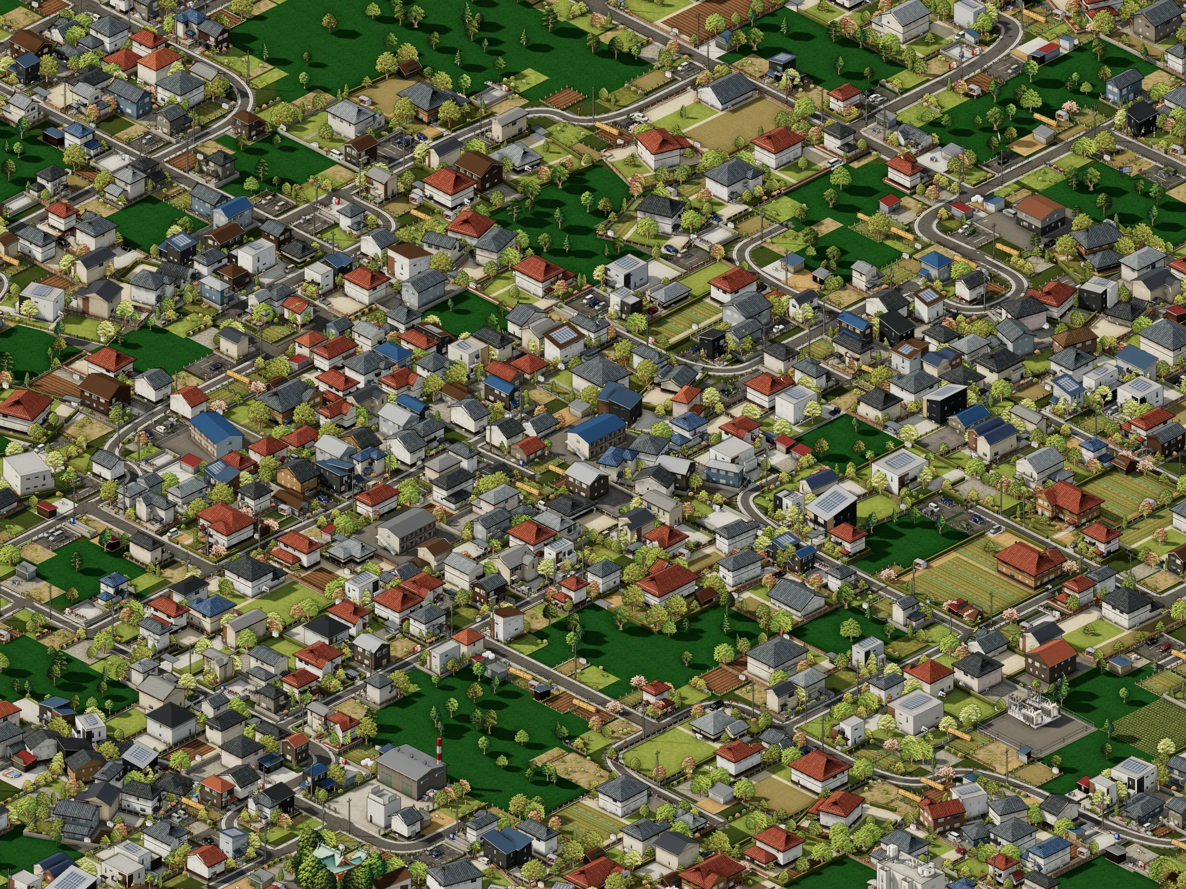 ZONINGZone it, and the town growsBuilding houses isn't the mayor's job. Zone the land and homes and shops go up, and get rebuilt, as the town needs them.
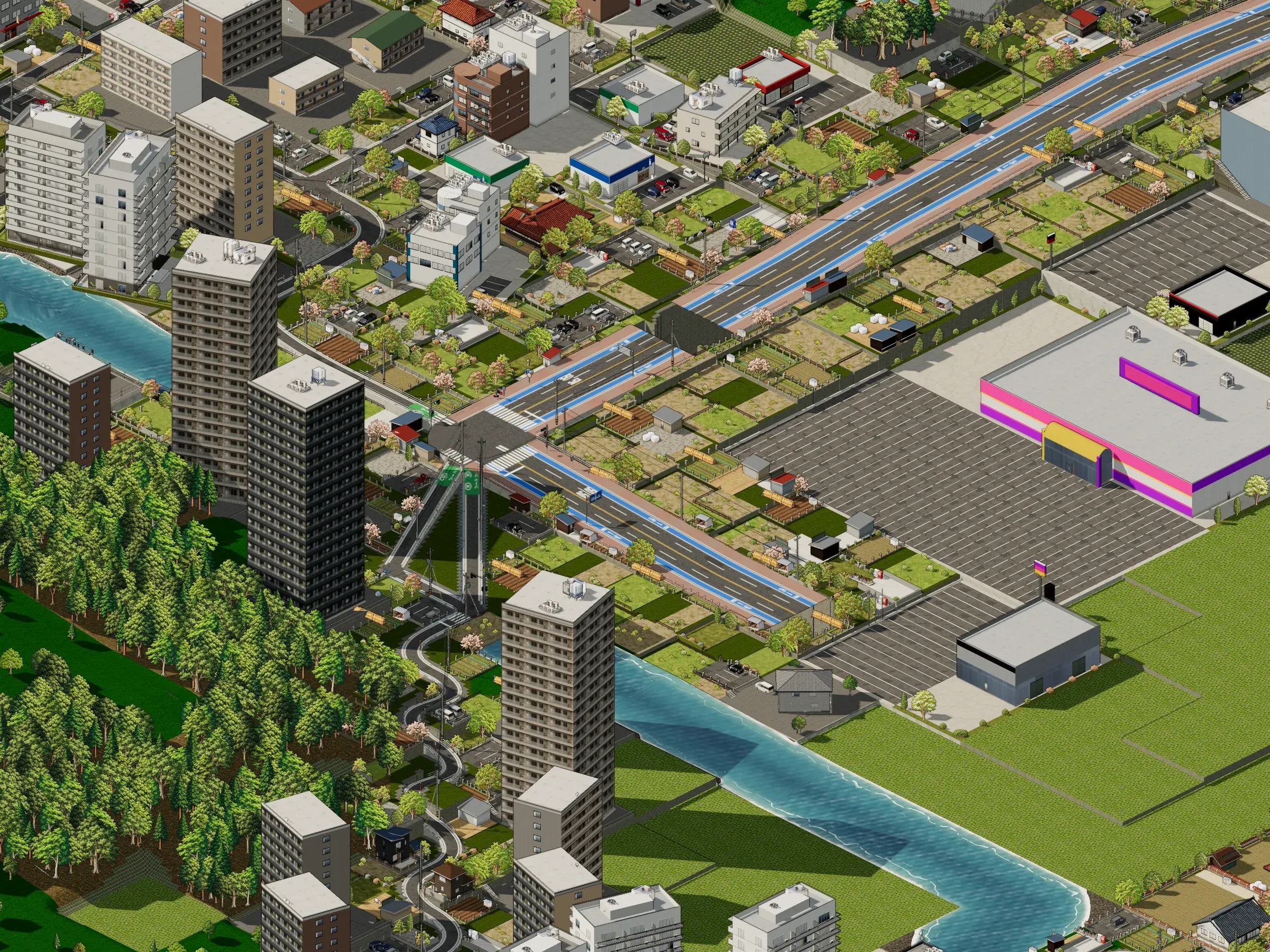 ROADSRoads at any angleRoads can run at an angle or curve. Junctions get lights, crossings and road signs to suit the roads that meet.
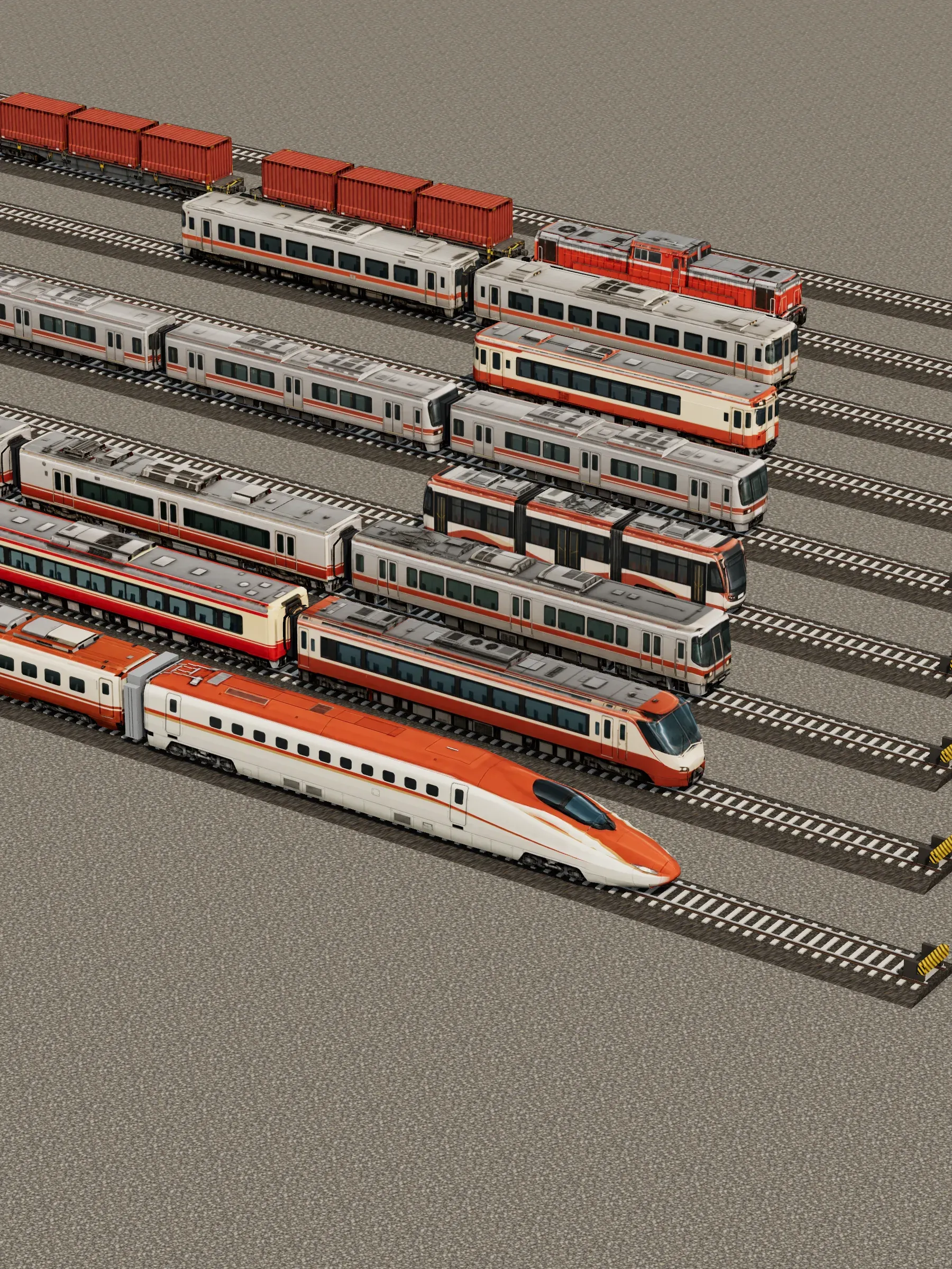 RAILWAYRailwaysShinkansen, limited expresses, freight, the subway and trams. Lay the track and build the stations, and more kinds of train run as the town grows.
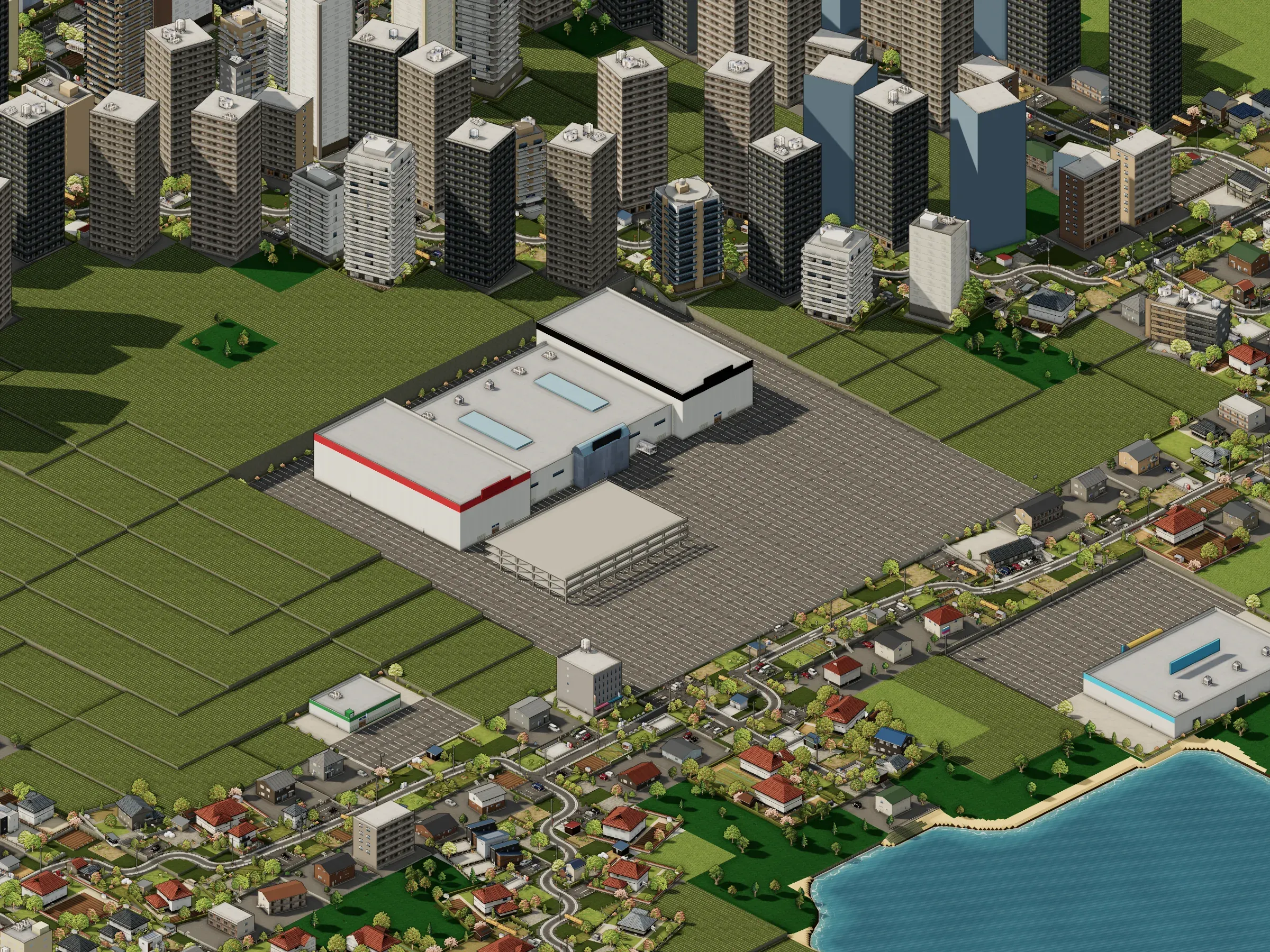 COMMERCECommerceShopping streets, chain stores, out-of-town superstores. Shops open where the customers are, and close when they don't sell.
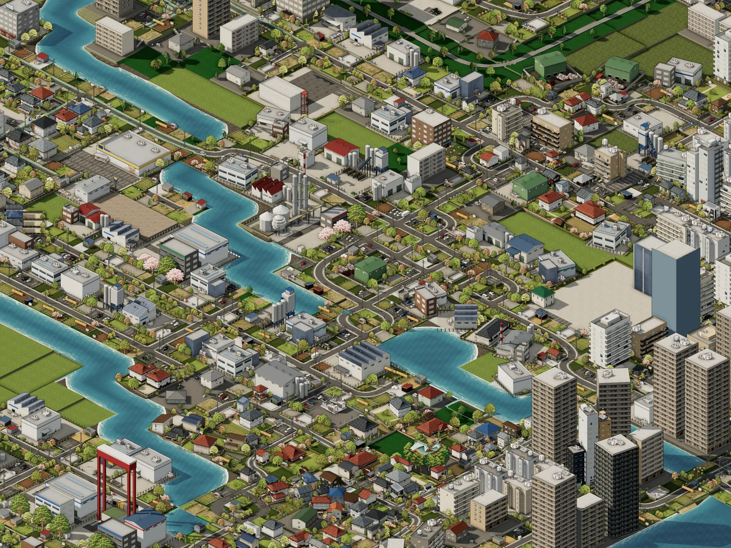 INDUSTRY & PORTFactories and the portFactories bring jobs, and people follow; shipyards go up on waterside industrial land. But the smoke and the noise reach the homes around them.
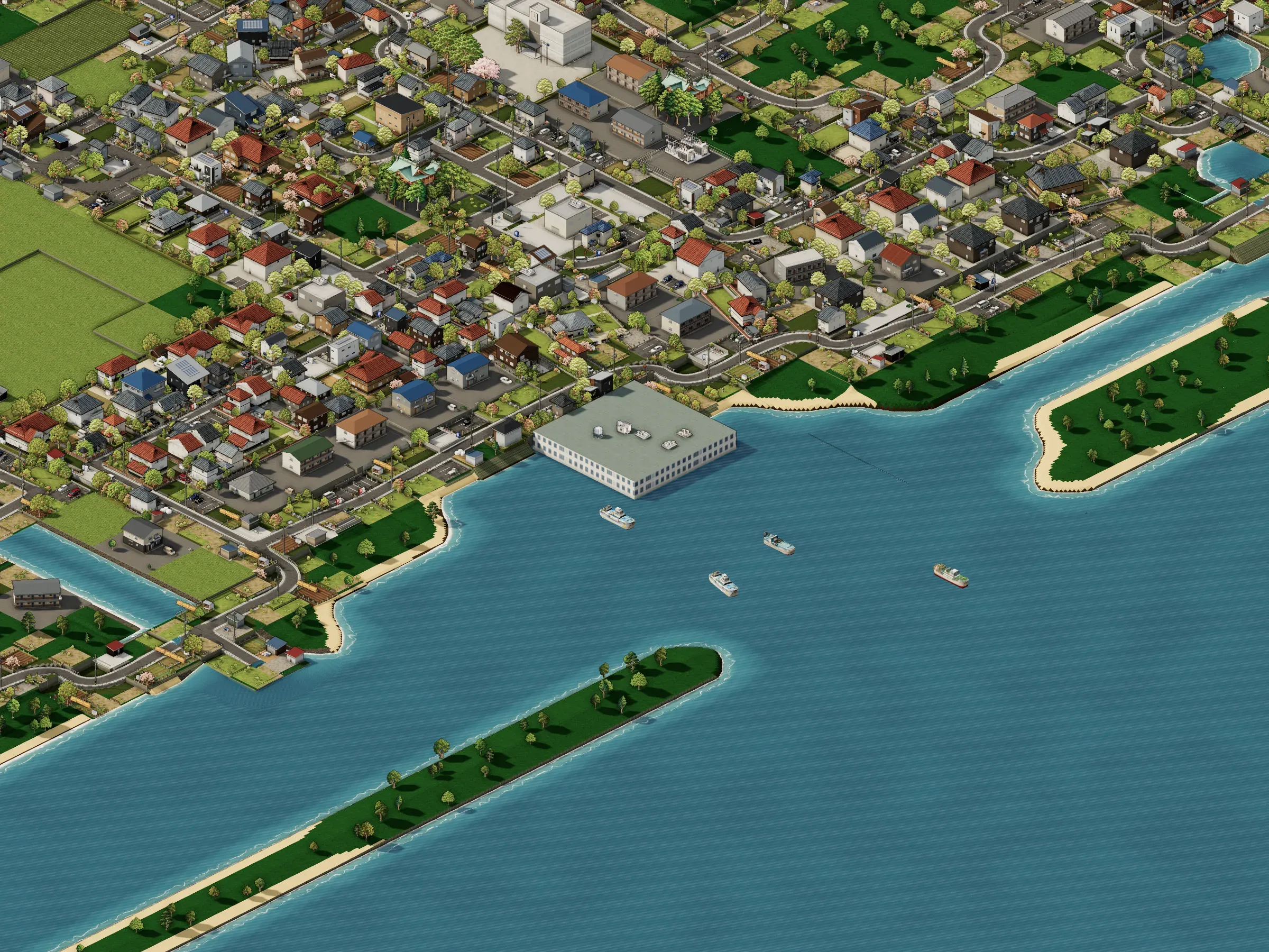 FARMING & FISHINGFarming and fishingFarms and the fishing port keep the town going. Fish with an eye on the stock: take too much and the fish run out.
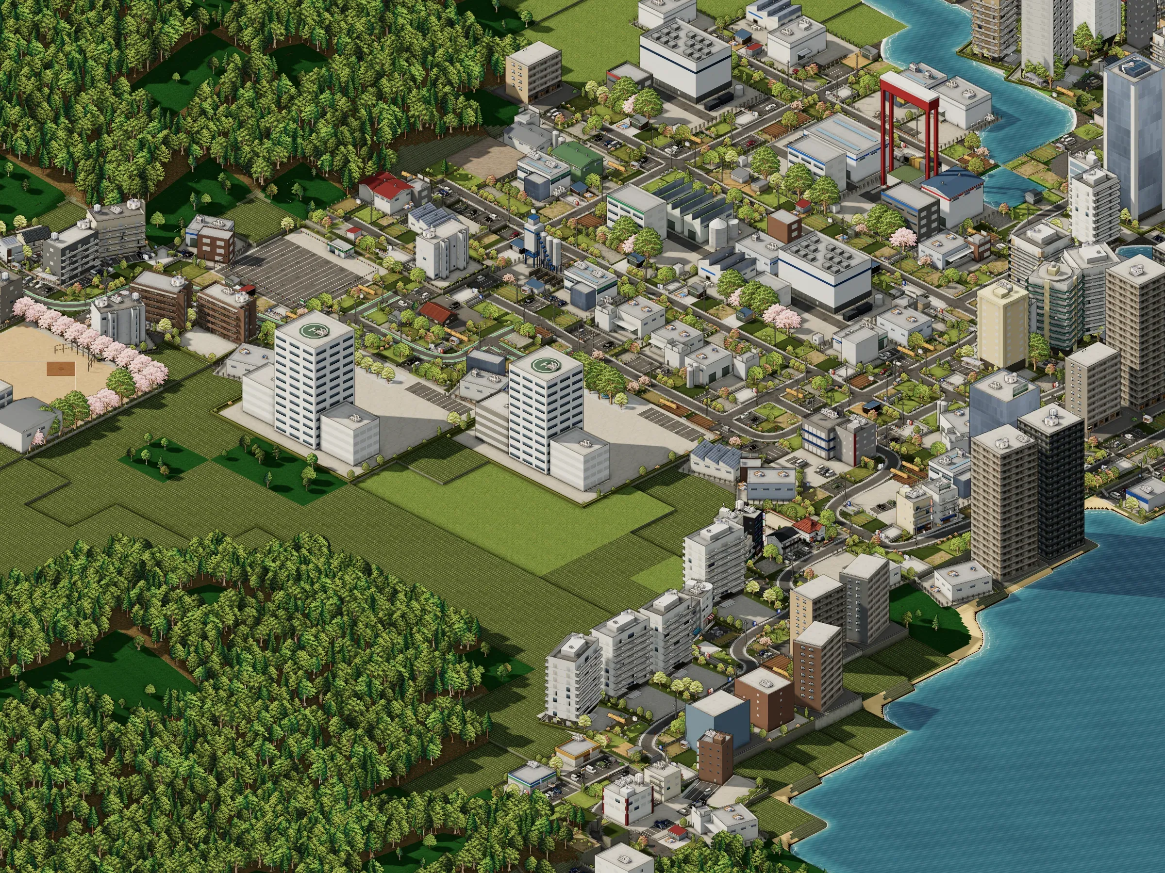 TOWN HALLThe town hall and public servicesThe town hall's departments place schools and hospitals as the population grows, and their chiefs' strengths and weaknesses shape the town too.
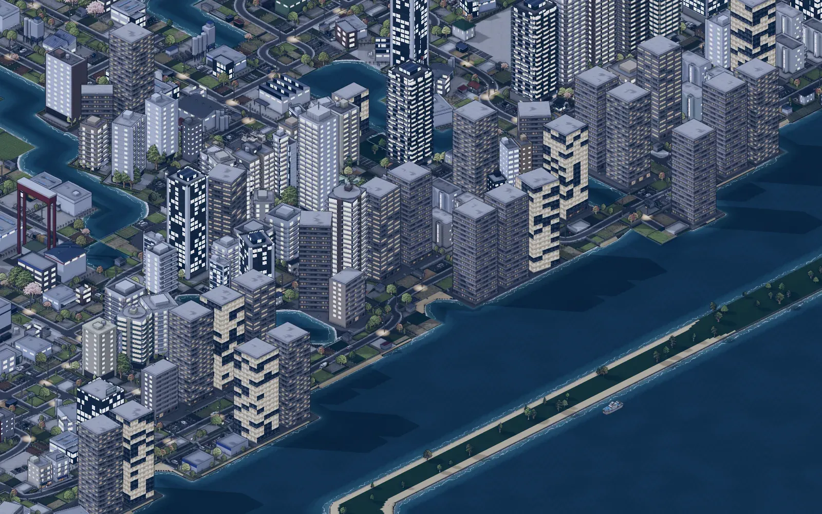
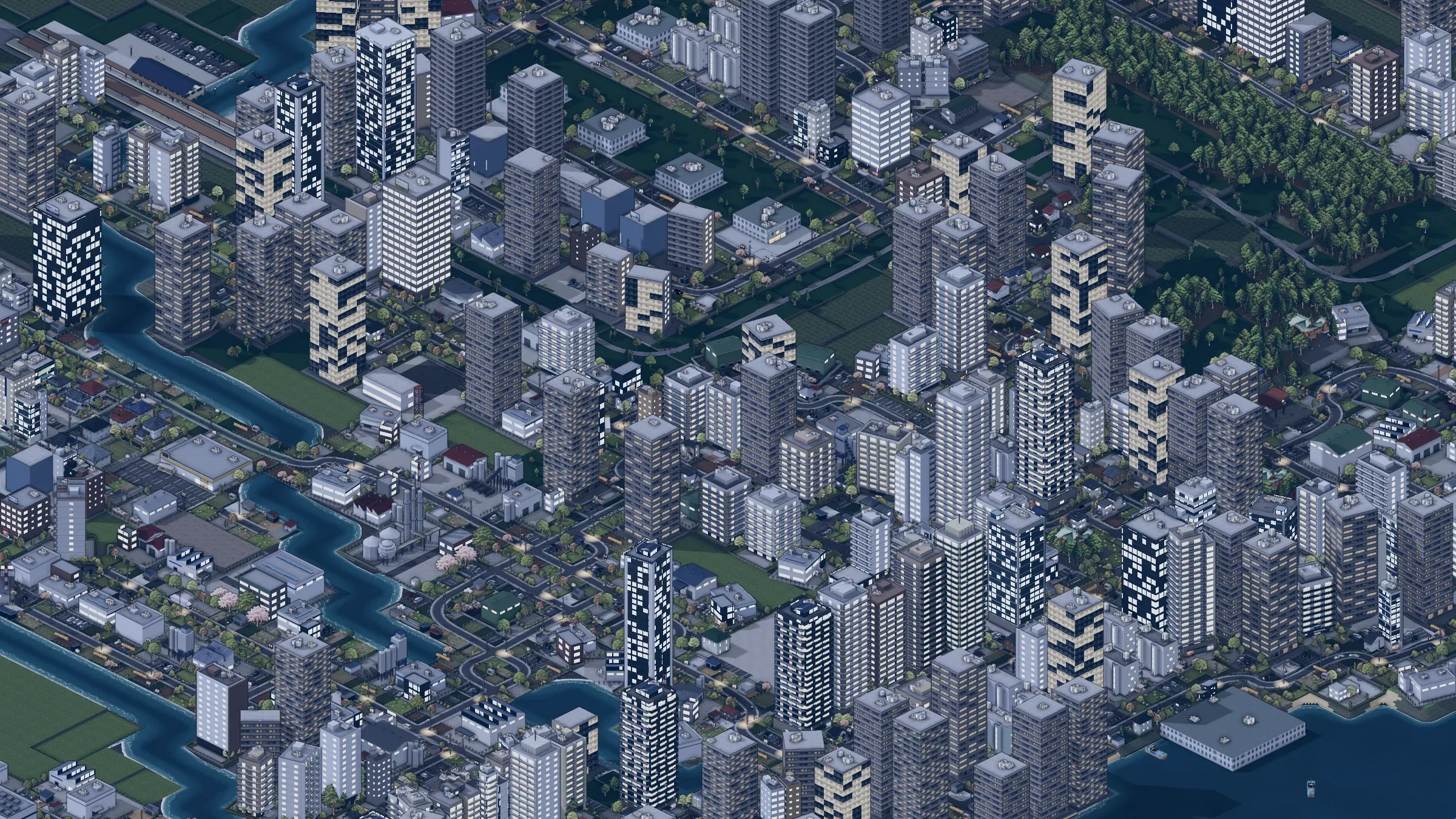 NIGHTThe town at nightAt dusk the windows and street lights come on, and the cars and trains keep running.
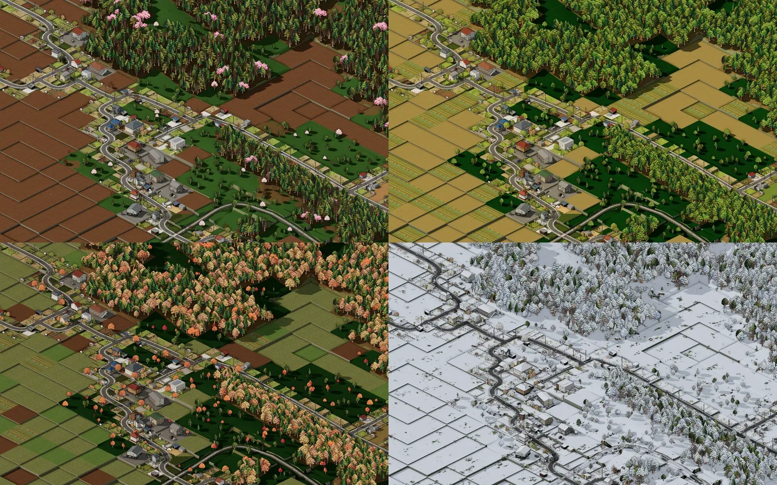
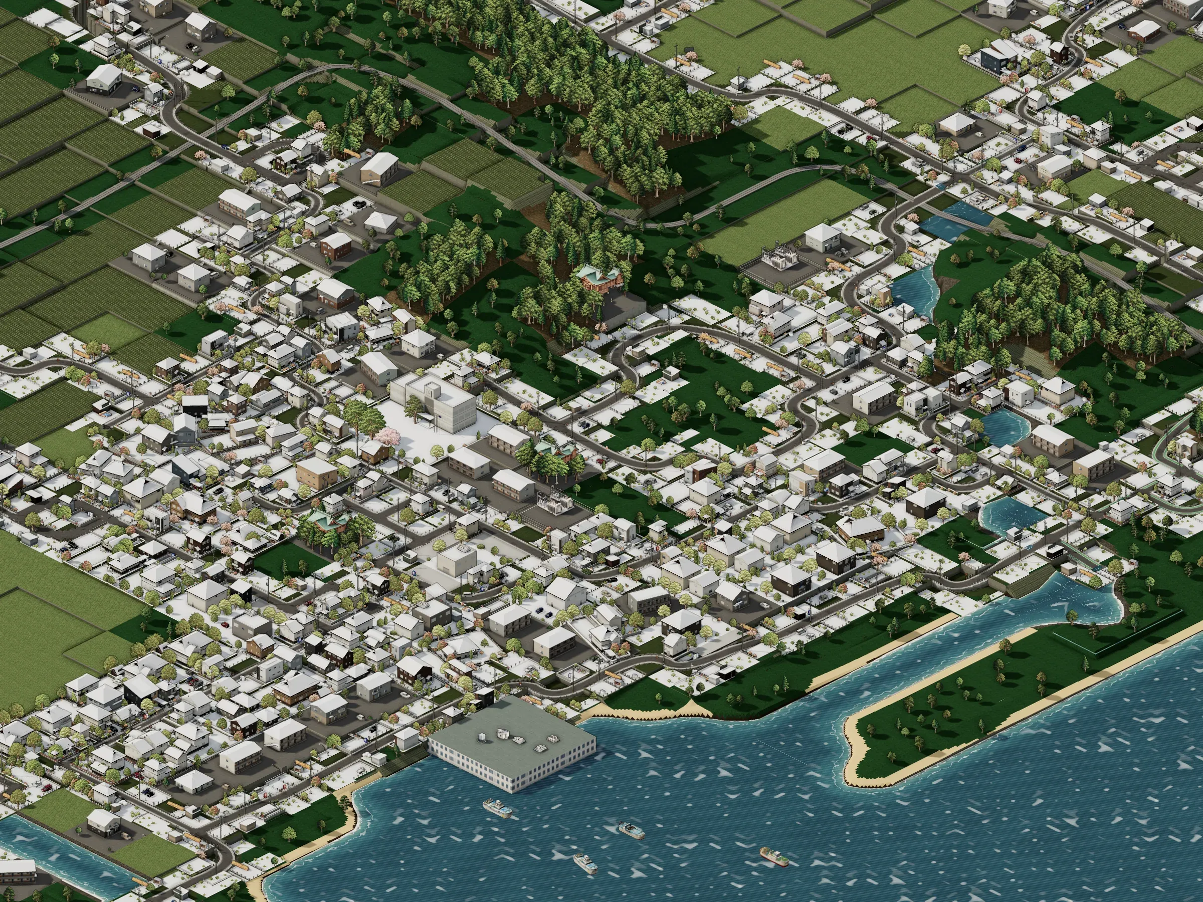 SEASONSThe seasons turnThe seasons turn month by month: cherry blossom in spring, snow in winter.
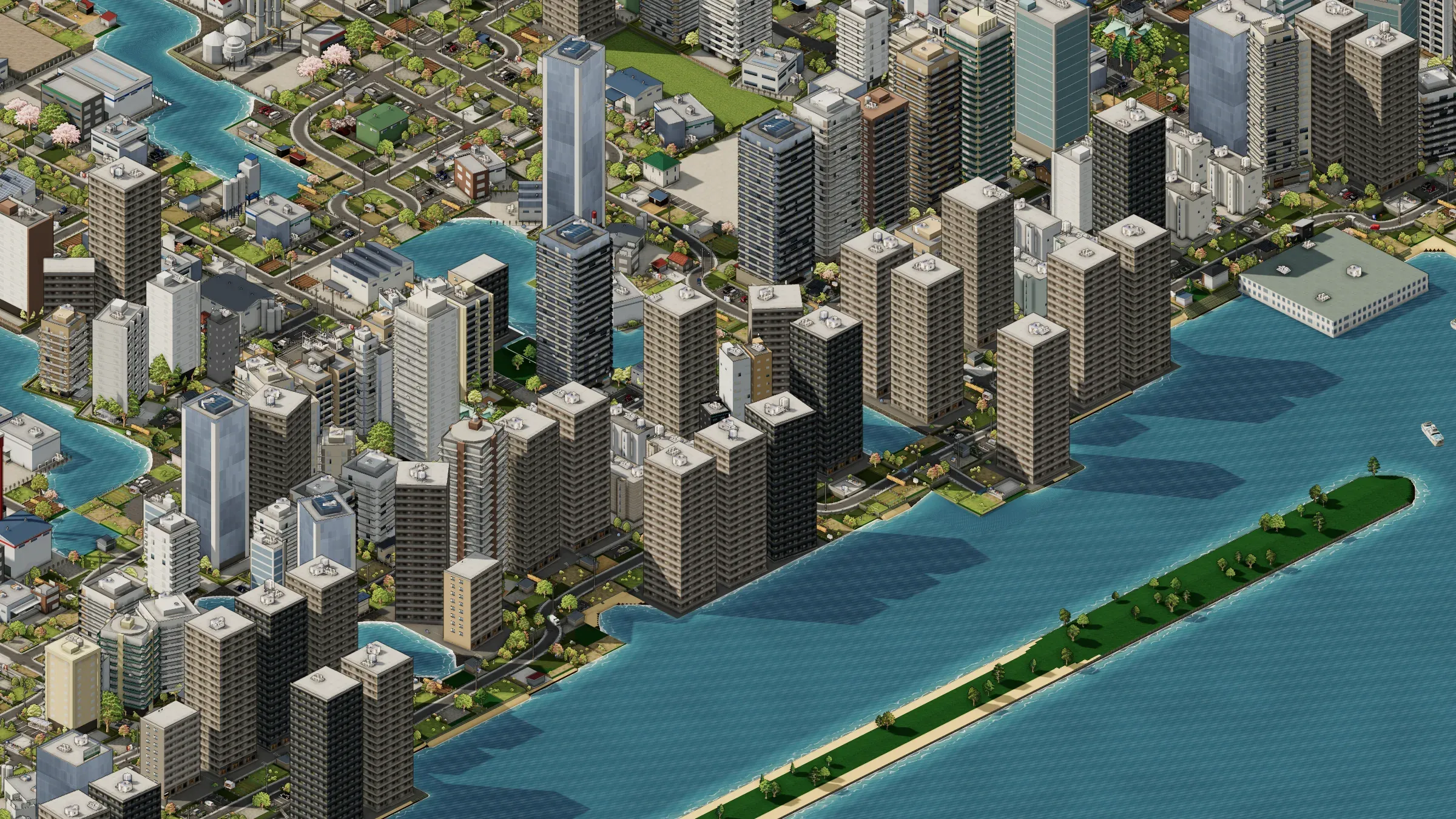
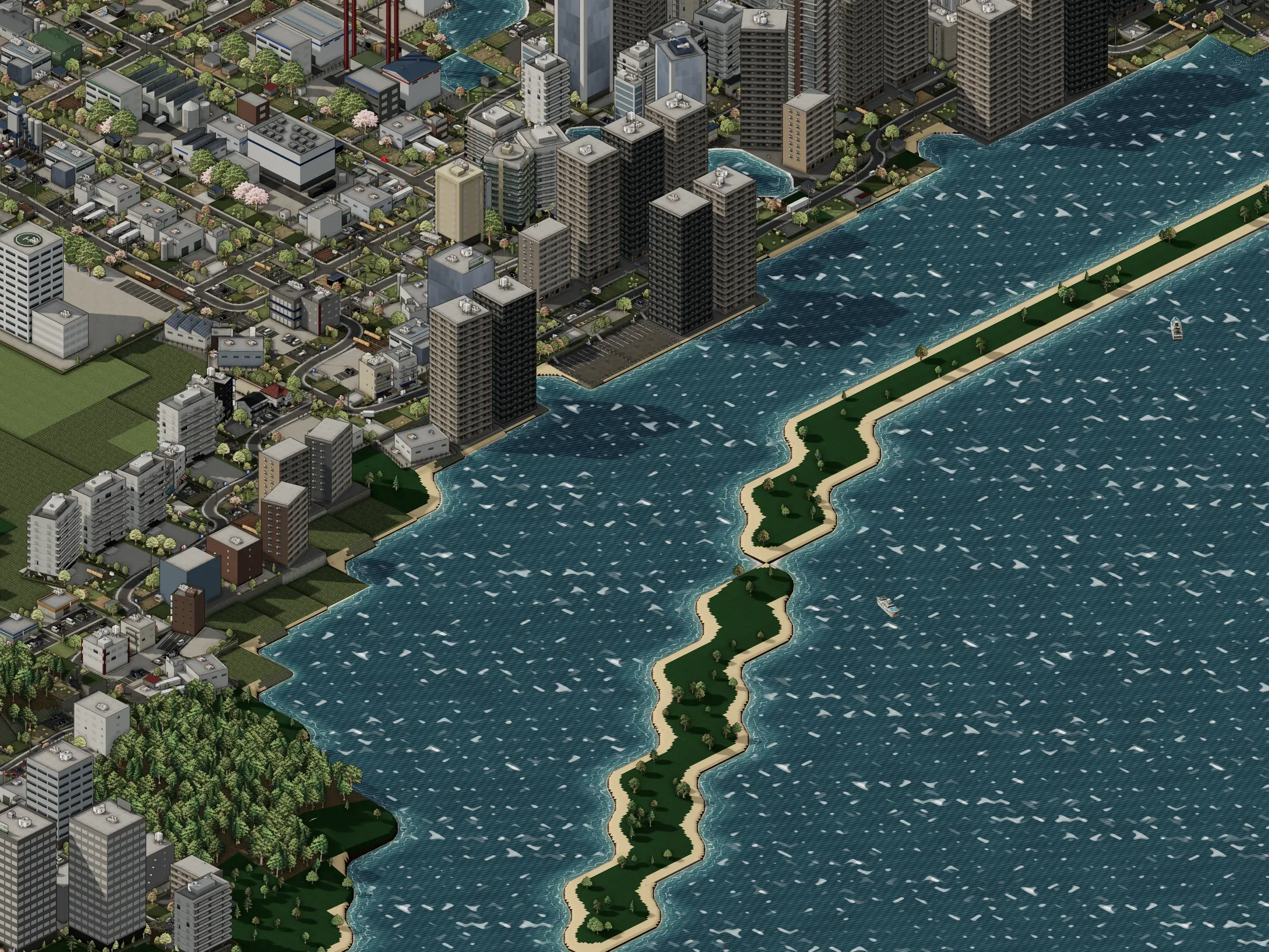 LAKESIDEOn Lake NakaumiThe town faces Lake Nakaumi: a port and boats, towers along the shore, the sky in the water, and white caps on stormy days.
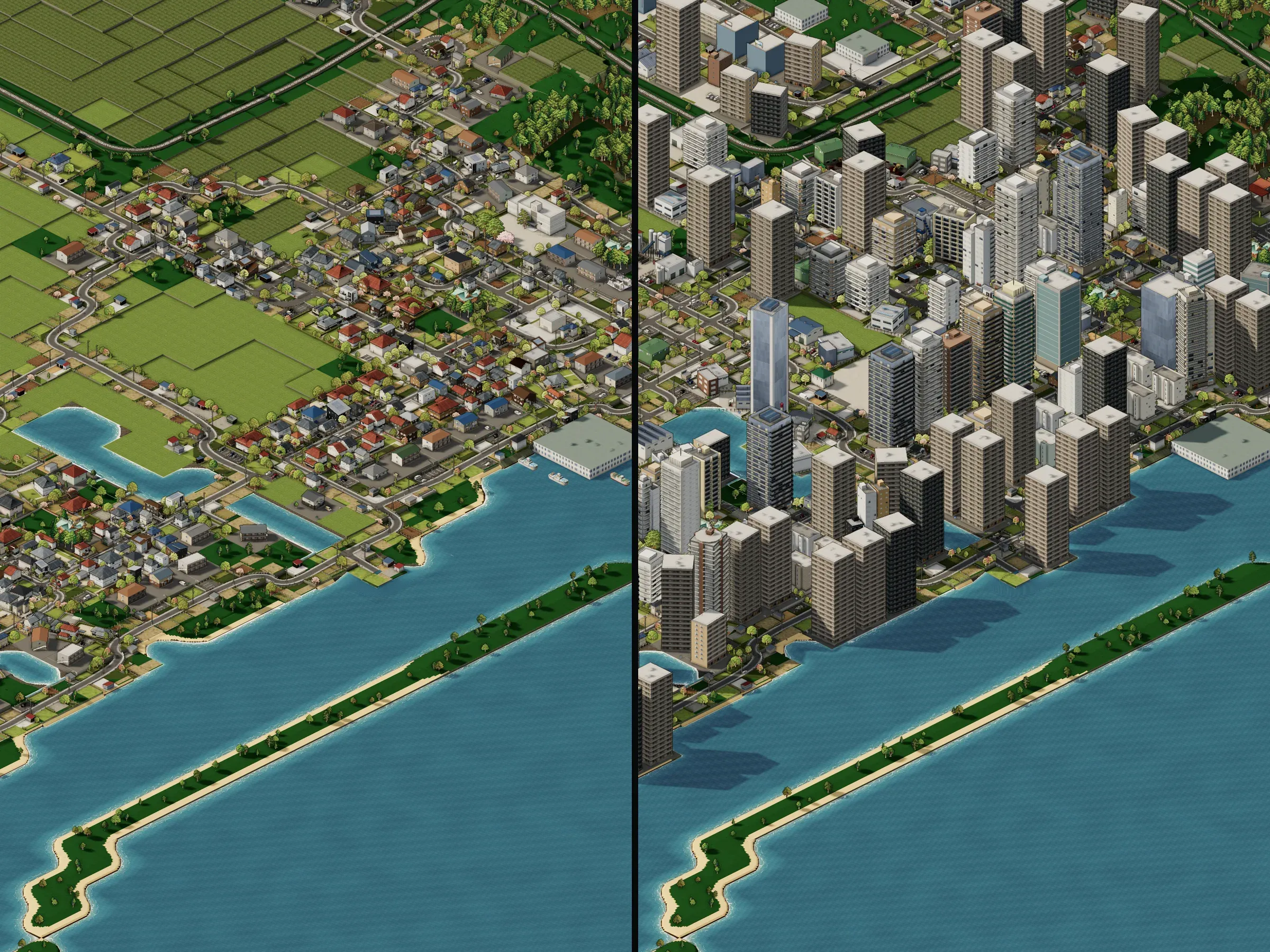 METROPOLISFrom town to city, and beyondMerge and win promotion again and again: the town becomes a city, then a designated major city, and towers rise on a shore that was paddies and houses at the start.
04Why I'm making it
All I can do is talk.
As a kid playing Red Alert 2 and Age of Empires, I liked laying out my base and just looking at it more than fighting. I loved the look of those games from that angle above, too. But neither of them is about building a town.
When I looked for town-building games, the simple ones never gave me the joy of putting a town together, and the realistic ones were so complicated that just getting started was hard work. Above all, none of them had that 2.5D view.
So I decided to make the game I wanted to play. The trouble is, I can't program and I can't draw. All I can do is talk.
Luckily, these days you really can make a game just by talking. Claude Opus 5.5 writes the code and puts the 3D town together, and gpt-image draws the textures, the trees and the pictures the buildings are modelled on. My part is to keep telling them what kind of game I want.
Since the end of October 2026 the map has been drawn in 3D, still from that same angle above that I loved.
05Dev log
A record of the days with big updates. Every screenshot was taken by running the game as it was on that day.
Day 34
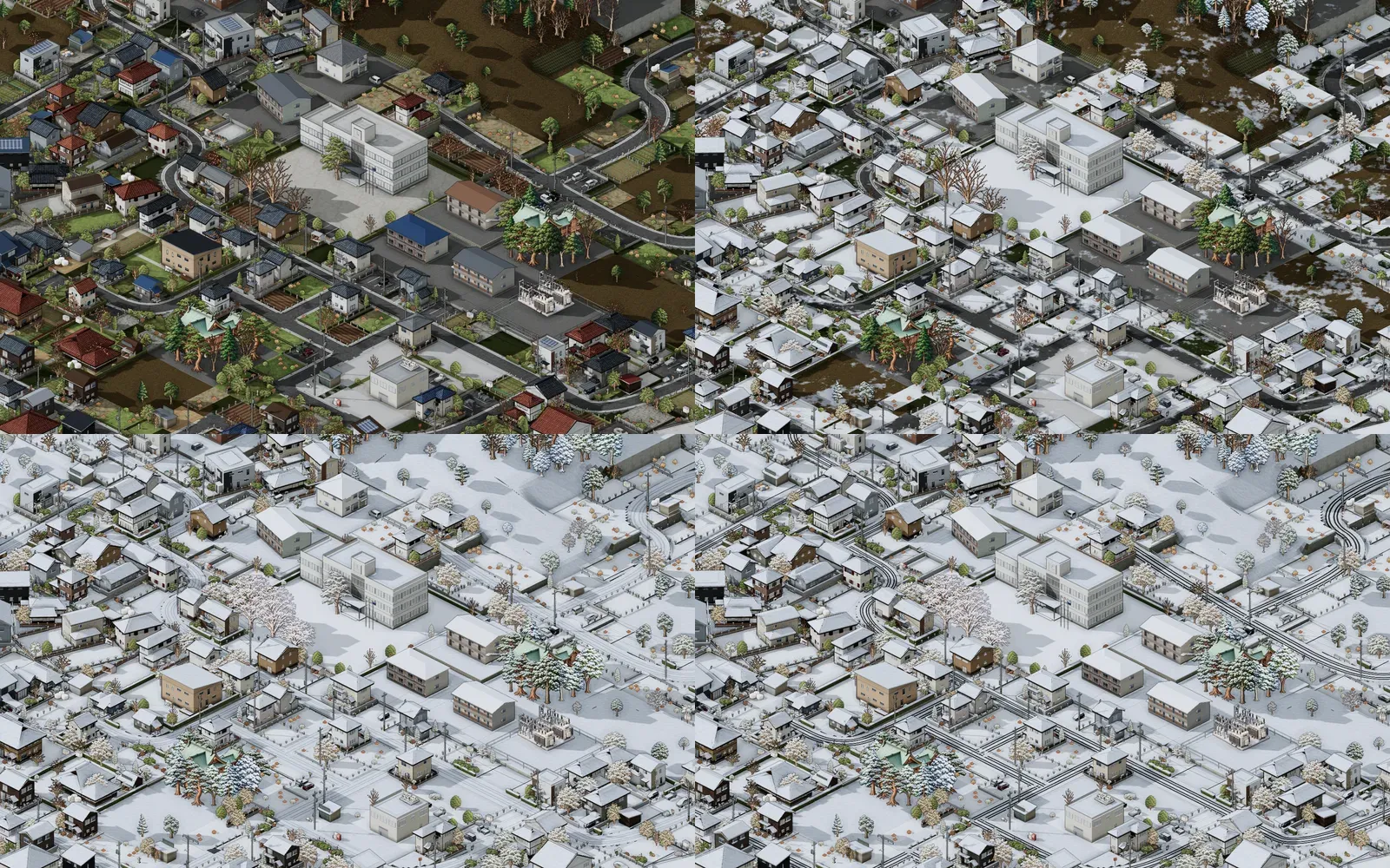
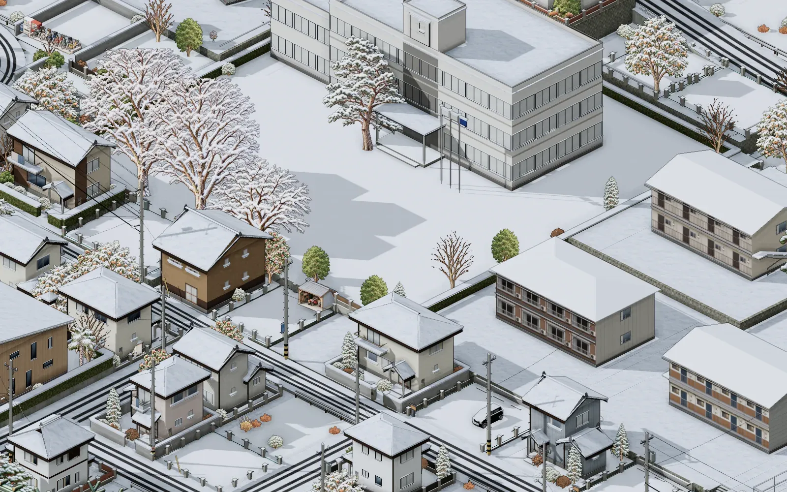
Snow now settles to a depth. How much falls each day follows the climate normals of the Matsue Local Meteorological Office, and it melts as the temperature rises; a snowy winter is the same winter the snow-clearing bill is counted for, and about one in ten is a heavy one. At 2 cm it is a patchy cover with the furrows showing through, at 5 cm everything is white, and past 15 cm the roads are cleared to the plan chosen in November (at 10, 15 or 25 cm). Roofs carry a thick layer with snow hanging over the eaves, town roads show grey ruts, main roads are wet and black with the snow pushed to the verges, cars collect snow on top, the falling snow thickens with the snowfall, and once it stops the sunny side melts first. Crape myrtles, weeds and flower beds no longer stay green through the winter.
Day 33
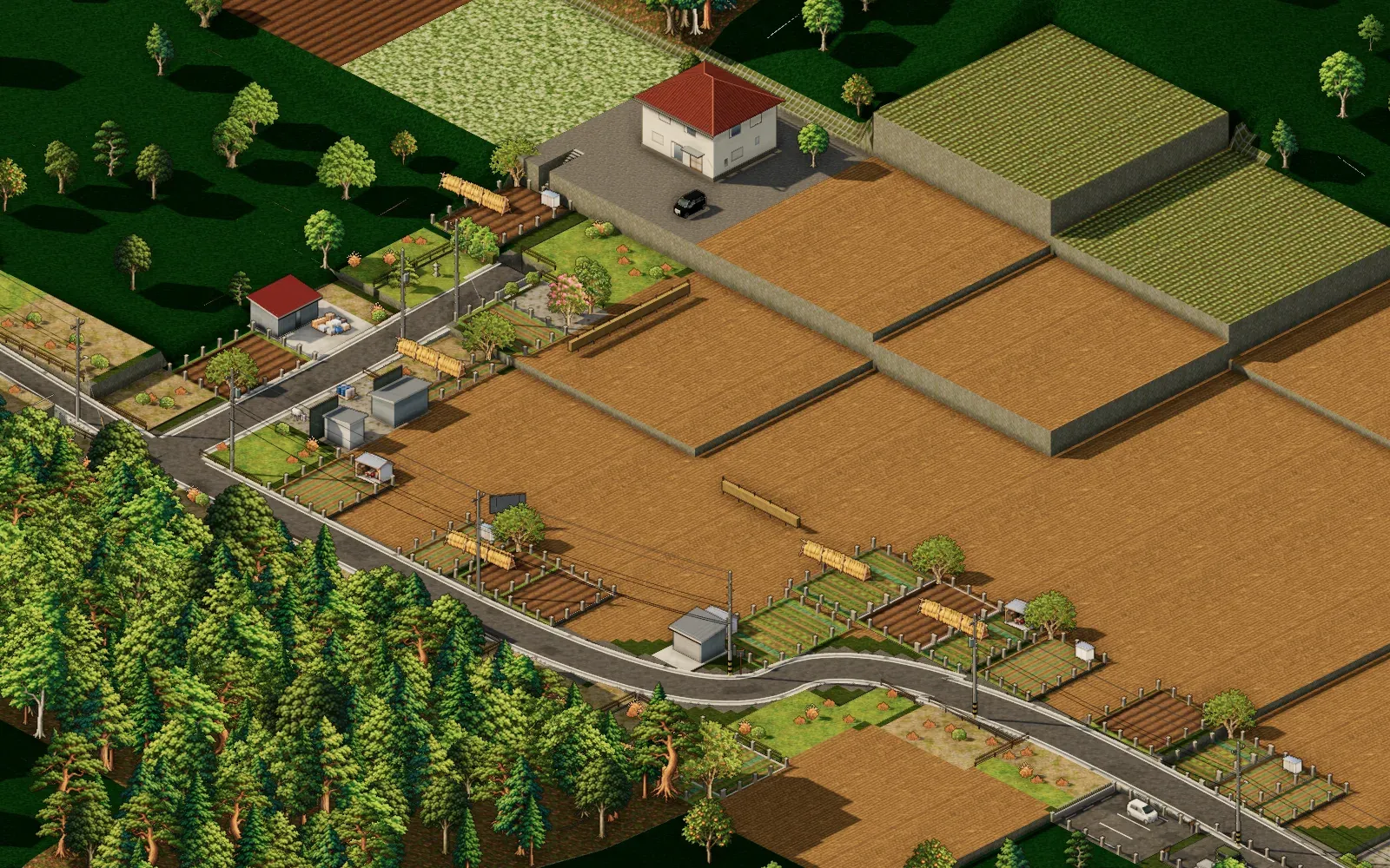
The 3D map now changes with the game's calendar, a little at a time. Cherry blossom comes out from late March into early April and the leaves turn in late November, a few weeks earlier up the hills. The paddies are flooded at the end of April, planted in May, green all summer, gold by late August and harvested in September, with the rice left to dry on racks. Peonies bloom on Daikonjima and buckwheat flowers in the fields. Snow falls and melts day by day, and in winter the sun sits low under grey skies. Carp streamers, New Year pine decorations and tundra swans mark the seasons too. The timing follows the climate normals of the Matsue Local Meteorological Office.
Day 32
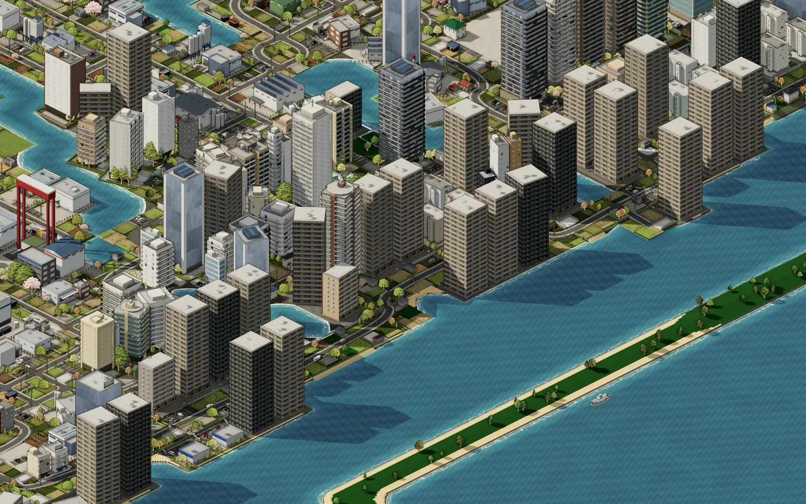
The towers were remade to match real aerial photos: their proportions, the spread of heights, their colours and the reflections in the glass. Glass towers and office blocks light up floor by floor at night. Lakes and rivers have rounded shores, waves, colours that follow the depth and reflections of the sky. Water from tsunamis, storm surges and flooding rivers now really flows into the town and pools in the low ground. Cars park at the factories, shipyards go up on waterside industrial land, and the shinkansen has proper tunnel portals. Around midnight the lighting was reworked too: the sun now comes from the upper left, shade gathers between buildings, the distance fades into haze, and the colours shift with the time of day.
Day 30
Where a road meets a railway you can now choose a level crossing, an underpass or a bridge over the line. New track crosses old track on a viaduct, ordinary roads can be raised on viaducts too, with ramps down to the streets at each end. The shinkansen runs on wide curves and gentle grades, passing through the hills rather than over them. Train cars now have couplers and gangway bellows between them. Zoomed far out, the map shows photos of the detailed blocks taken in advance, so you see the town rather than grey boxes.
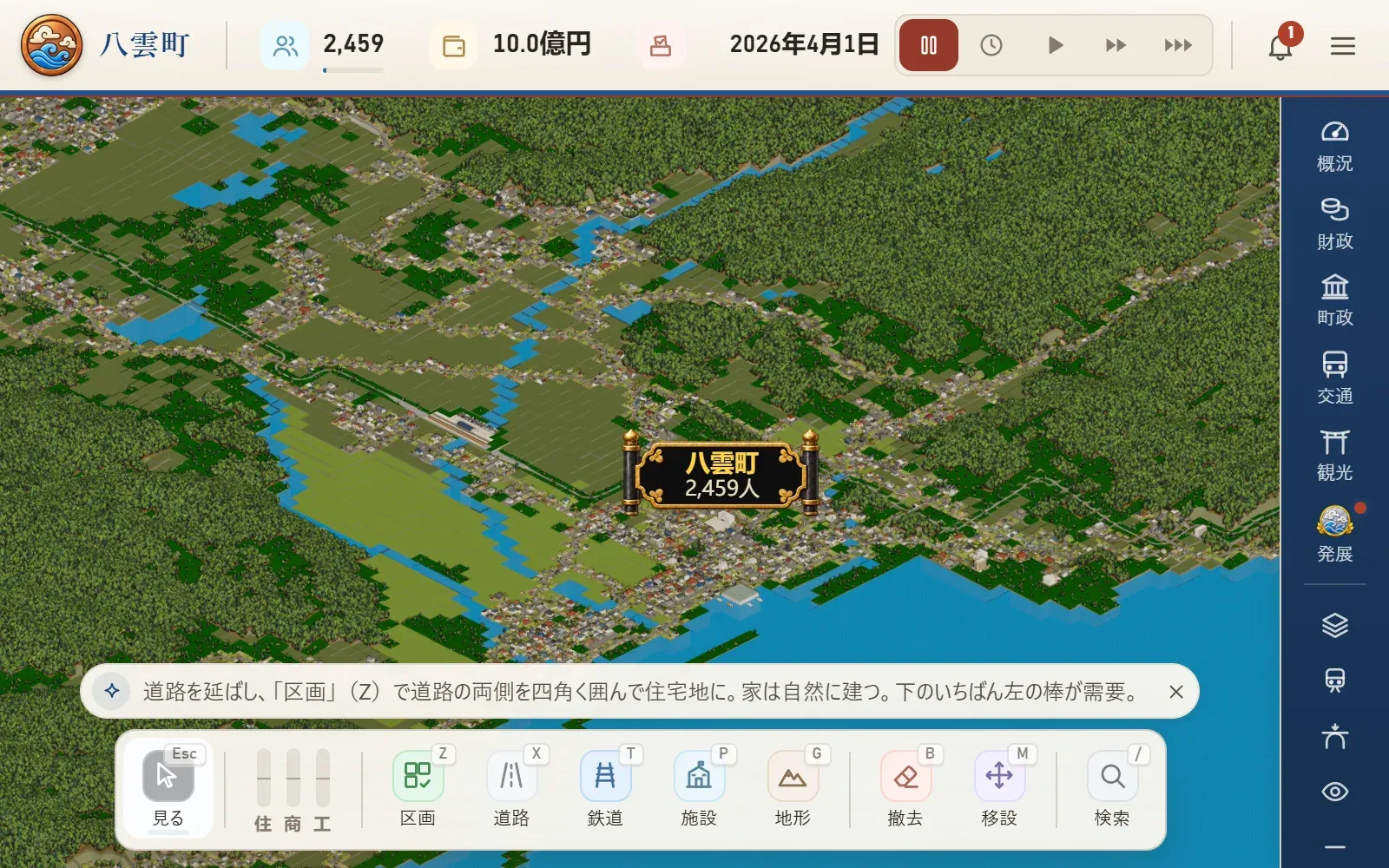
Day 29
Traffic lights now stand at 3D junctions: the signals for cars on the far left corner, pedestrian signals on every corner, and a sign with the junction's name. The lights change on the same clock as the cars. Road signs, road markings and billboards went in, modelled on the real thing, and the utility poles and wires were rebuilt. There are gutters between the road and the plots now, and the plots reach right to the road's edge. Small shops with a family living upstairs go up too.
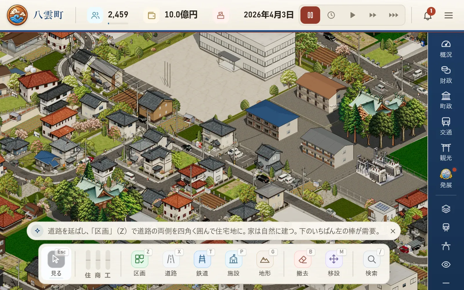
Day 26
Houses, shops and factories are now built in 3D one at a time, modelled on the existing art. Detached houses alone come in 14 families, down to tiled ridges, window frames, walls and gardens. Roads, like railways, can now run at an angle, and the JR line at the start follows its real alignment. At night the moon lights the town so you can still see it, and zooming in from far away no longer stalls while it loads. On the title screen you can also pick the faster-paced career mode.
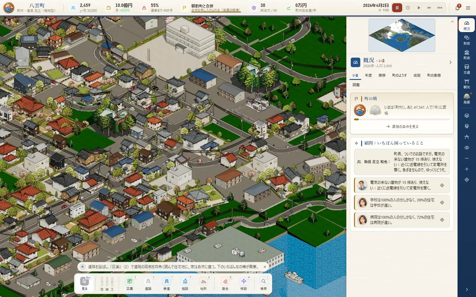
Day 25
Railways are now stored as centre lines, free of the grid. In 3D the track is drawn as diagonal straights and curves, the change from single to double track gets a real-world No. 10 turnout, and stations can sit along the line at any angle. In the morning 1,104 new pieces of art for the 3D view were finished and went into the game: new cars, trains, ships, people on foot and rooftop details. Several endings, a relaxed mode with no disasters or money worries (just building and watching), and scenarios recreating the 1943 and 2000 Tottori earthquakes came the same day.
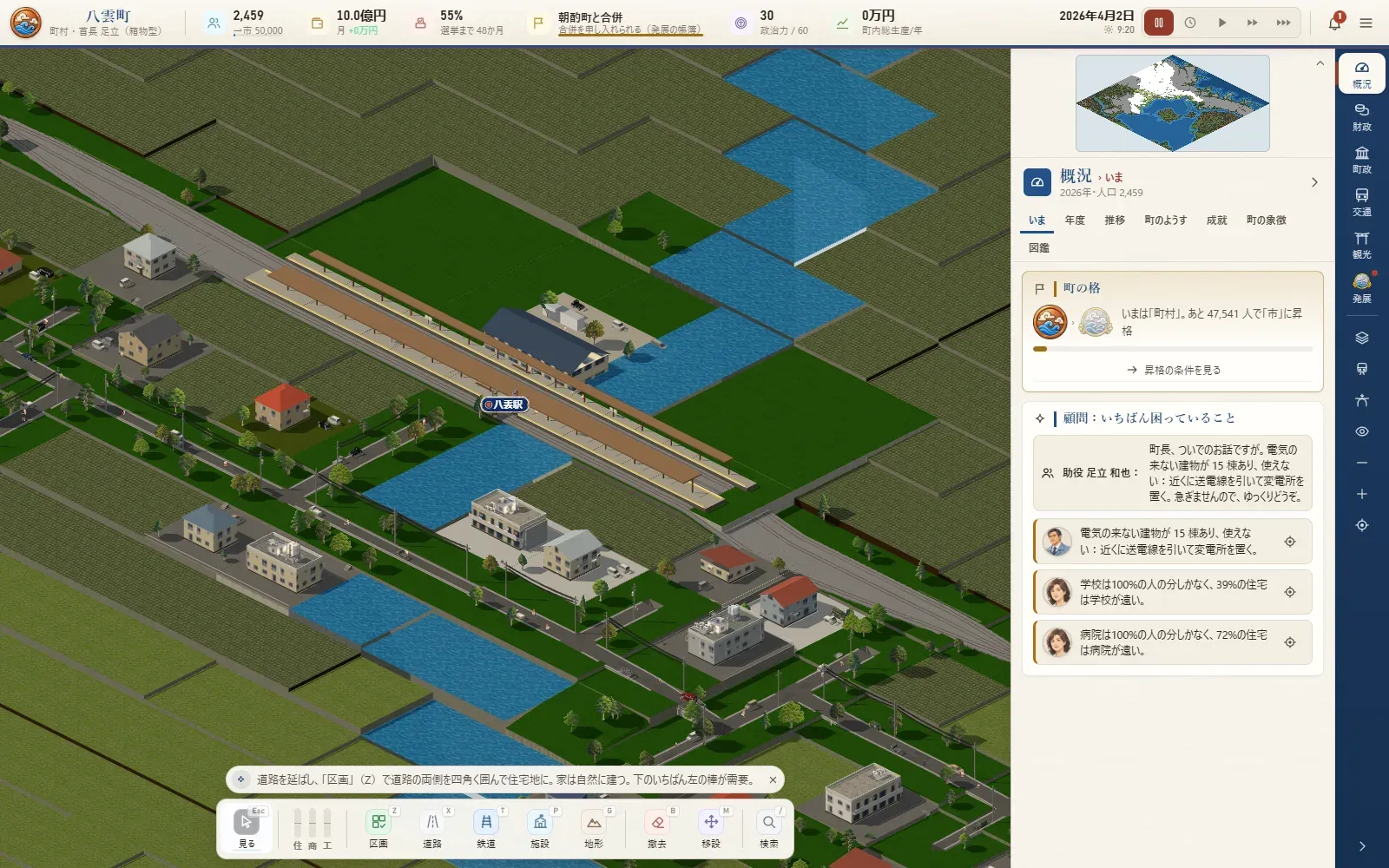
Day 24
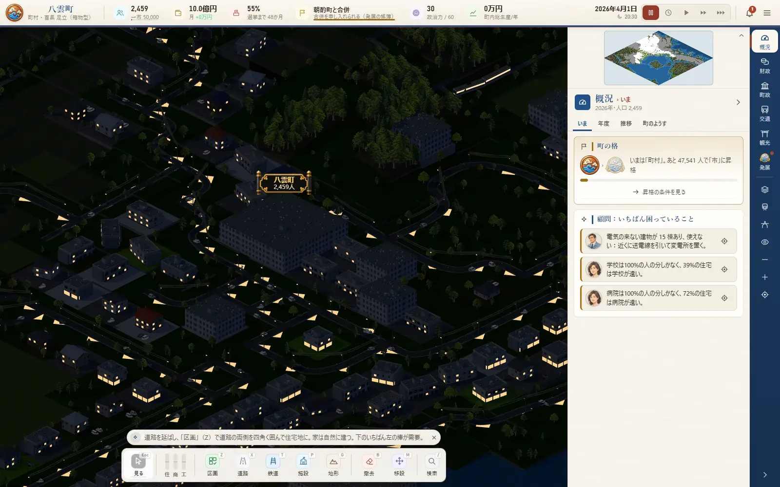
Cars, trains, ships and people on foot are back on the 3D map. The light changes from day to night, windows light up after dark, and it rains and snows. The starting map, finished the night before, came in too: rebuilt from the Geospatial Information Authority's elevation data, map data and aerial photos. Every house now has its own household and an address with a real postcode. Local specialities, 66 achievements, a town flower, tree and mascot arrived as well, and work began on new art for the 3D view.
Day 23
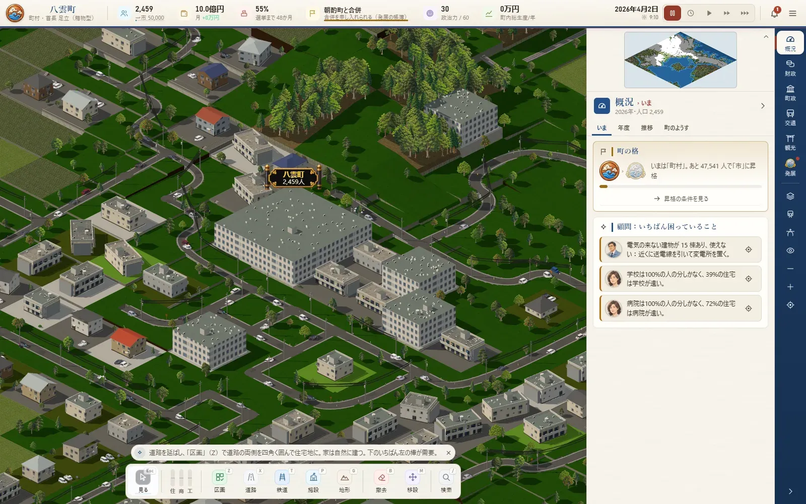
The map is now drawn in 3D with WebGL. The view from above at an angle stays the same, but roads become smooth curves, plots are cut along the streets, and slopes are drawn as retaining walls and steps. The same day brought the budget council, community buses and shared taxis, the landfill, and sea walls with evacuation shelters.
Day 22
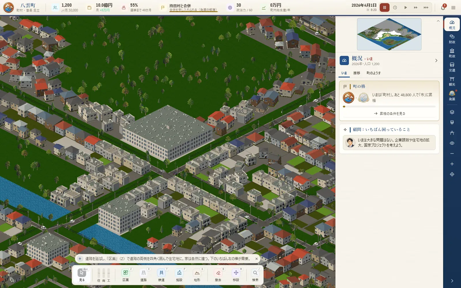
Election night with the live count, the referendum on a merger, becoming a city, the first shinkansen, the airport opening, talks with the national government: each big moment now plays out on the spot for about ten seconds. At the end of the year, a special issue of the town newsletter looks back. Elevated stations, viaducts down the middle of avenues and stairs in hillside streets arrived the same day.
Day 21
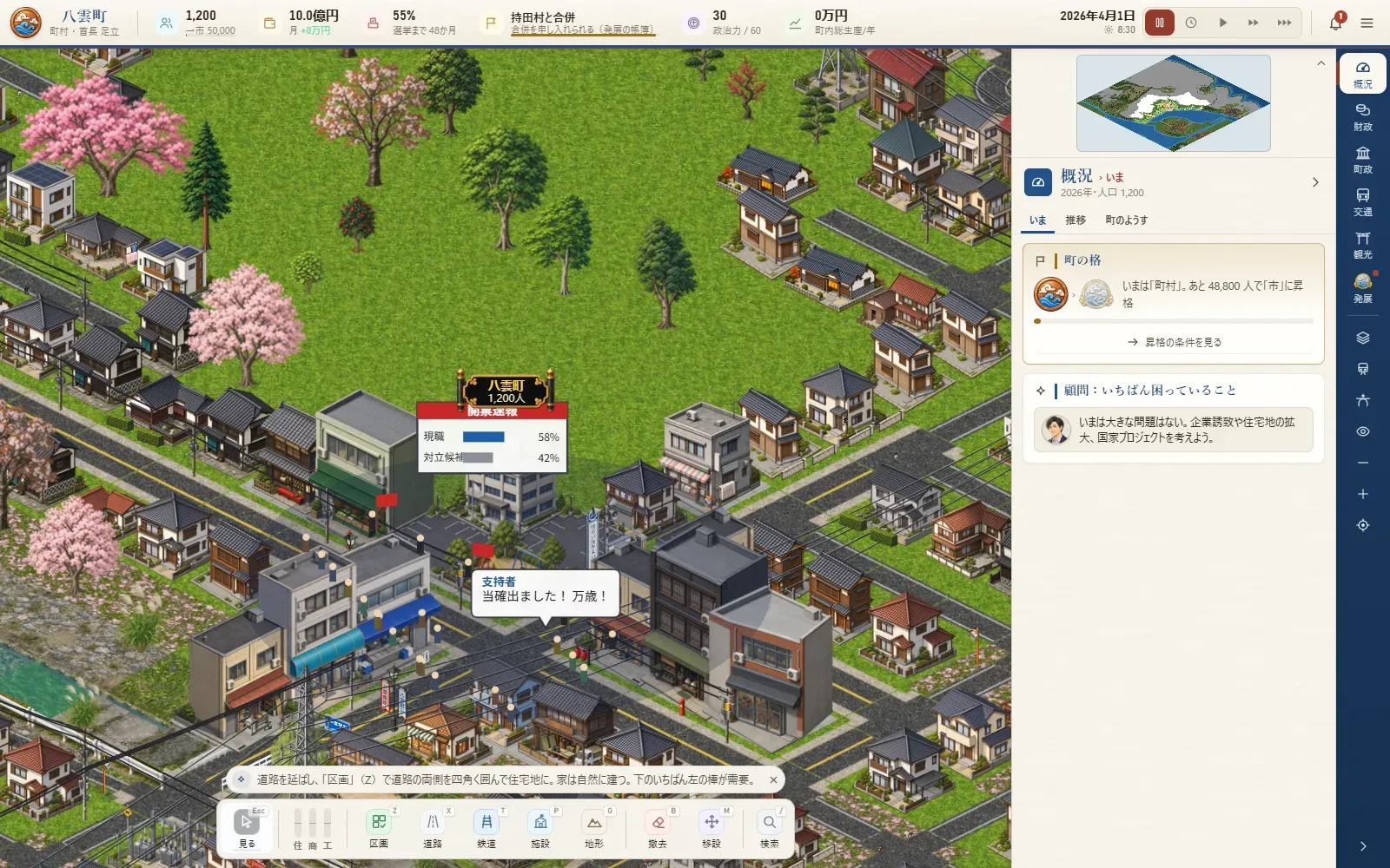
Double track now takes two tiles and quadruple track three, and the passing loops at single-track stations became real second tracks. Stations grow through six sizes; big ones get station buildings with shops inside, and their passengers join the shopping catchments. A web version you can play right in the browser can now be built too.
Day 20
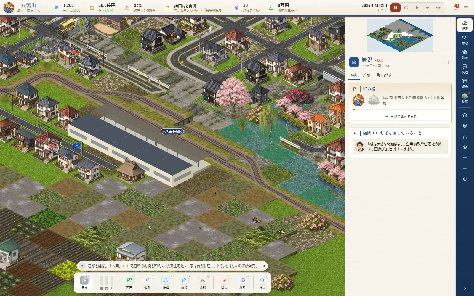
The rebuild of the game's foundations, under way since 13 October, is finished. This day alone added a full expressway system, named townspeople with lives of their own, parking, a ten-year forecast before big decisions, and undo (Ctrl+Z). In the evening the screen was repainted in the bright colours of San'in (washi paper, indigo, Sekishu roof tiles), and the town newsletter at the start of each month became a five-second animated card.
Day 19
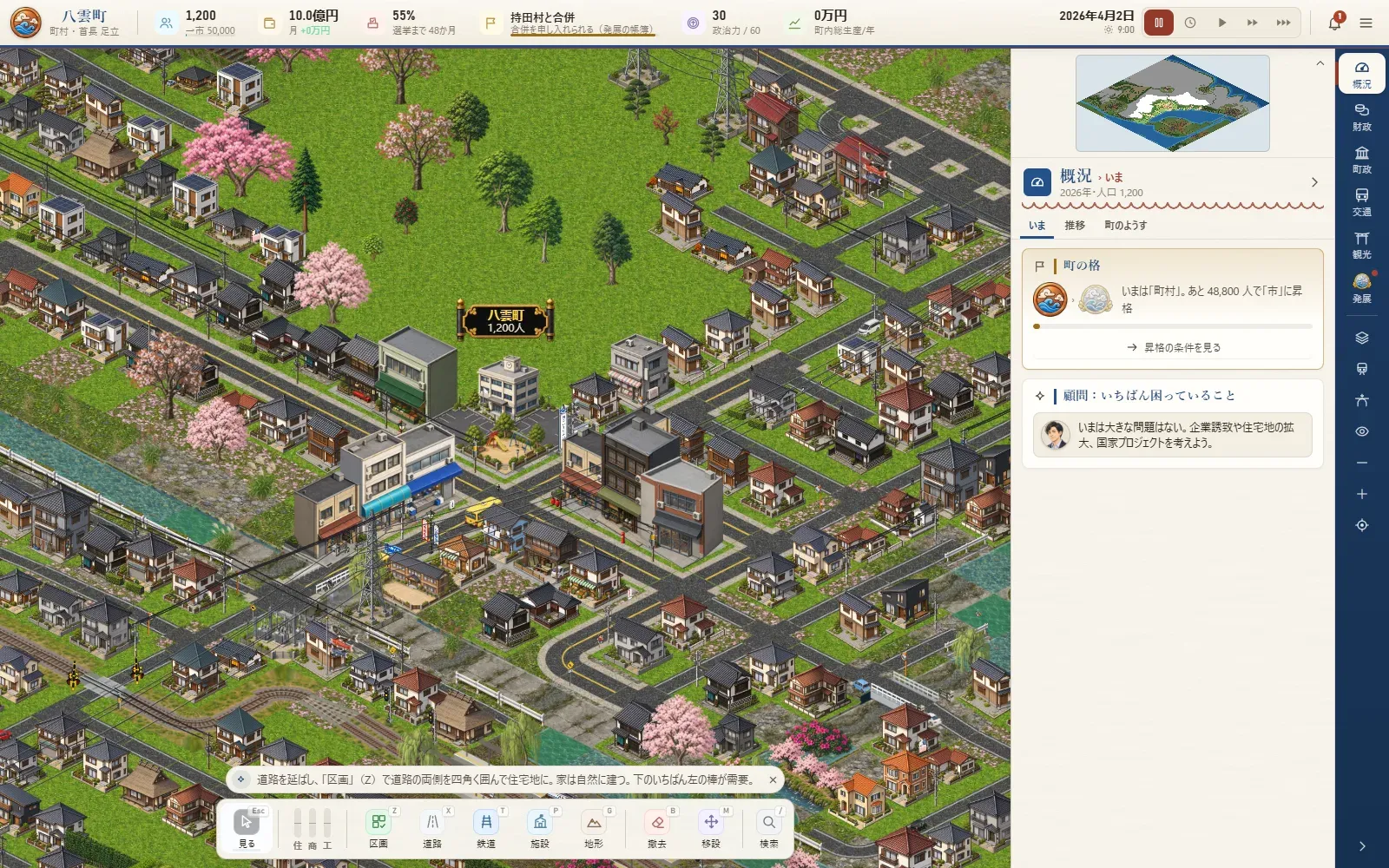
Heights went from 4-metre steps to single metres, and the land became smooth. Roads cut through hills on their own so they never get too steep, and housing estates on slopes are graded into terraces. The maps of merged cities gain plateaus, hills and alluvial fans. Conversations now show the speaker's silhouette and name.
Day 18
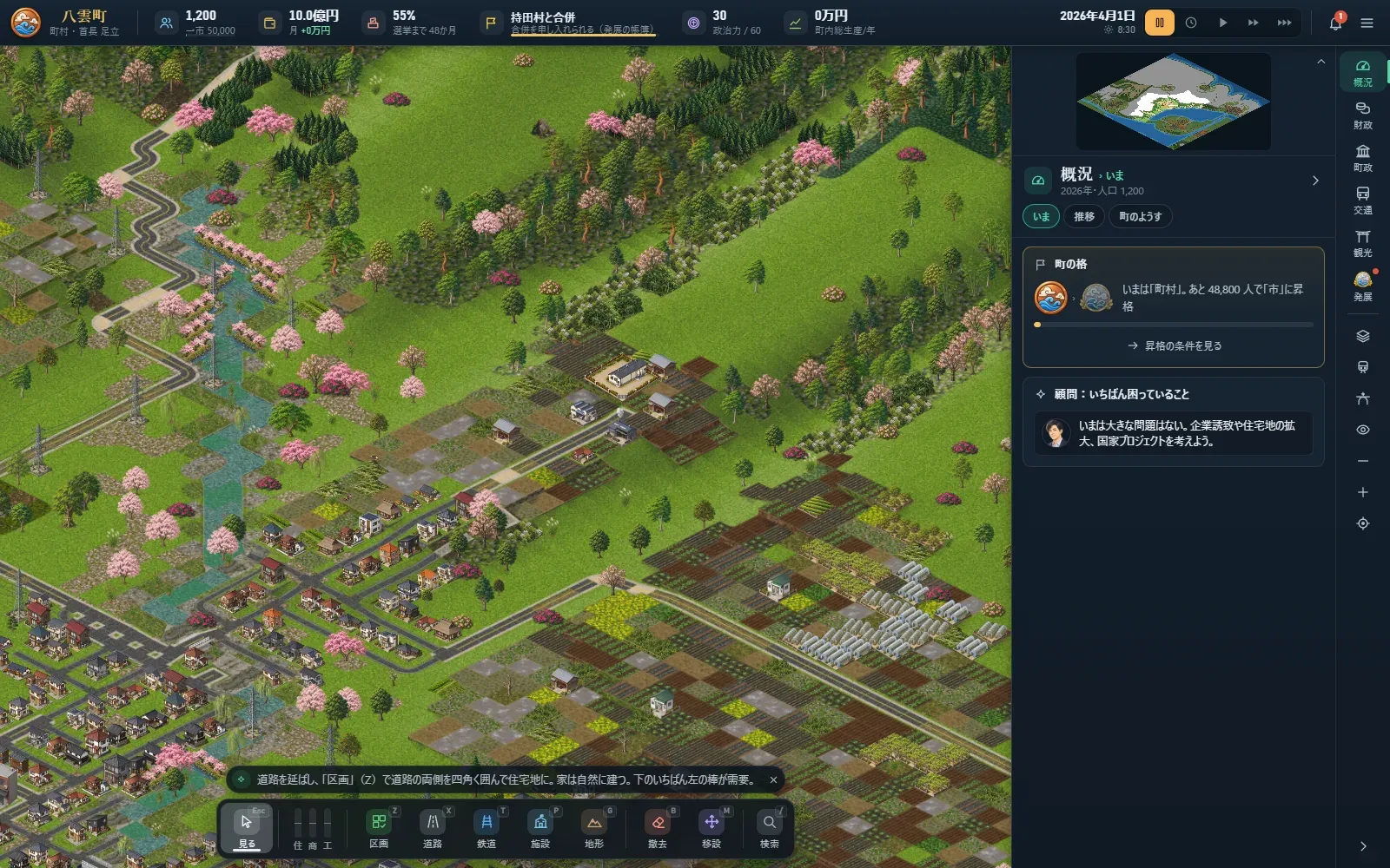
The town hall became a real building on a corner of the crossroads at the centre of town. As the town grows the offices get cramped, and you choose whether to rebuild, extend or move into an empty building. People walk up to the doors, open them and go inside. Shopping arcades, road flyovers and the waterworks accounts came the same day.
Day 17
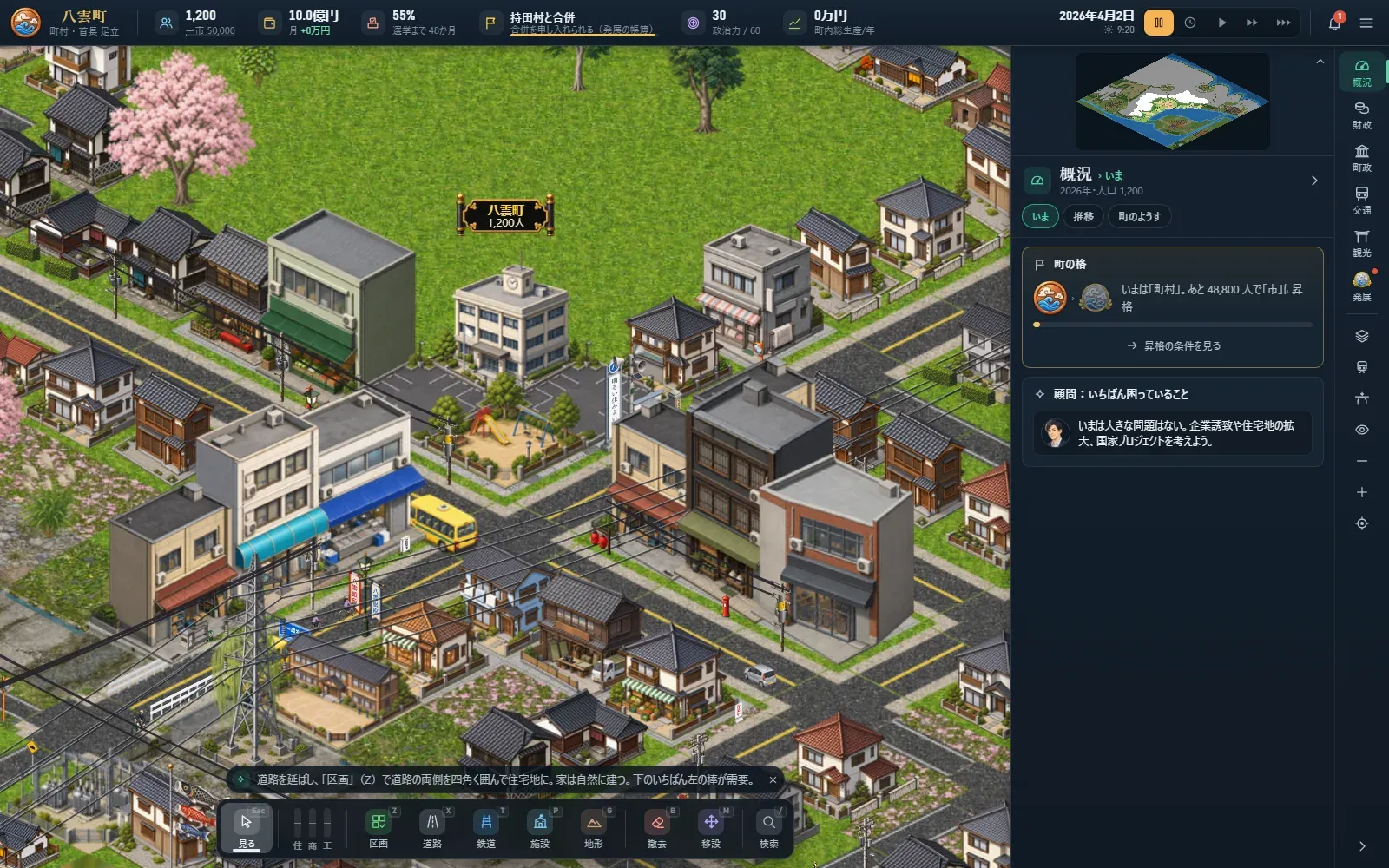
Zoning now follows Japan's real seven kinds, from low-rise housing to industry. A zone says what may be built; what actually goes up depends on demand. Junctions get stop lines, lane arrows and "止まれ" (stop) markings, and the direction signs name the real places that lie that way.
Day 16
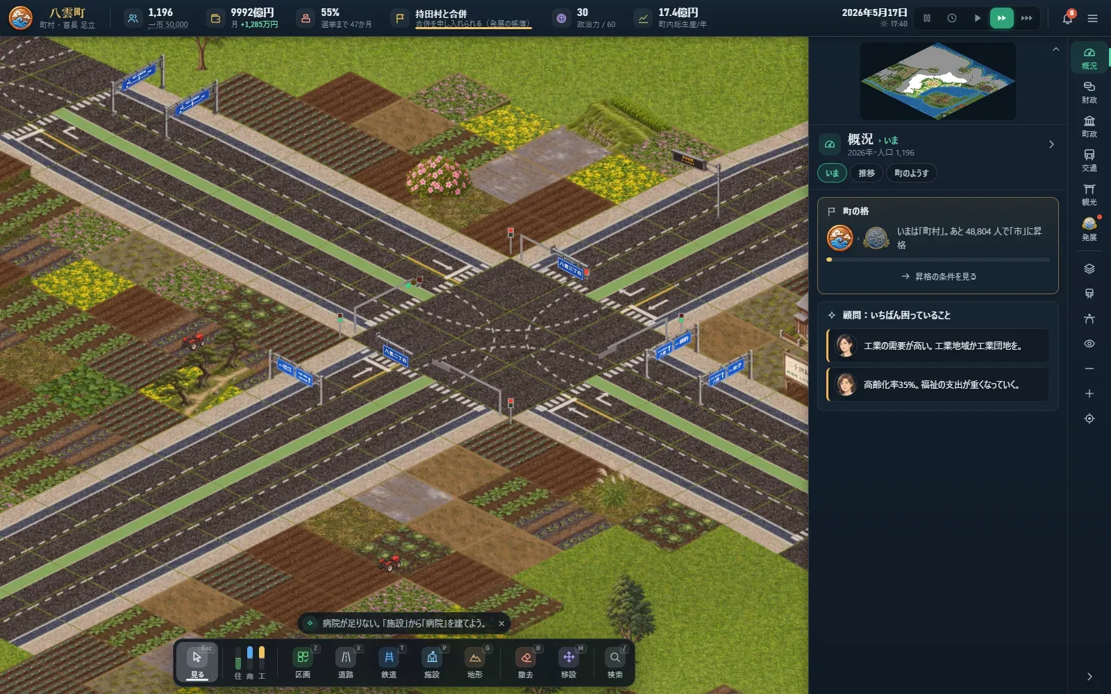
Trade is no longer one number for the whole town but worked out by catchment: who shops where, including the pull of the shops in Matsue, Yonago and Izumo. Shops that don't sell close, and empty big stores wait for a new tenant or the wrecking ball. Merge with Matsue or Yonago and the centre of that city becomes a second map you can build on.
Day 15
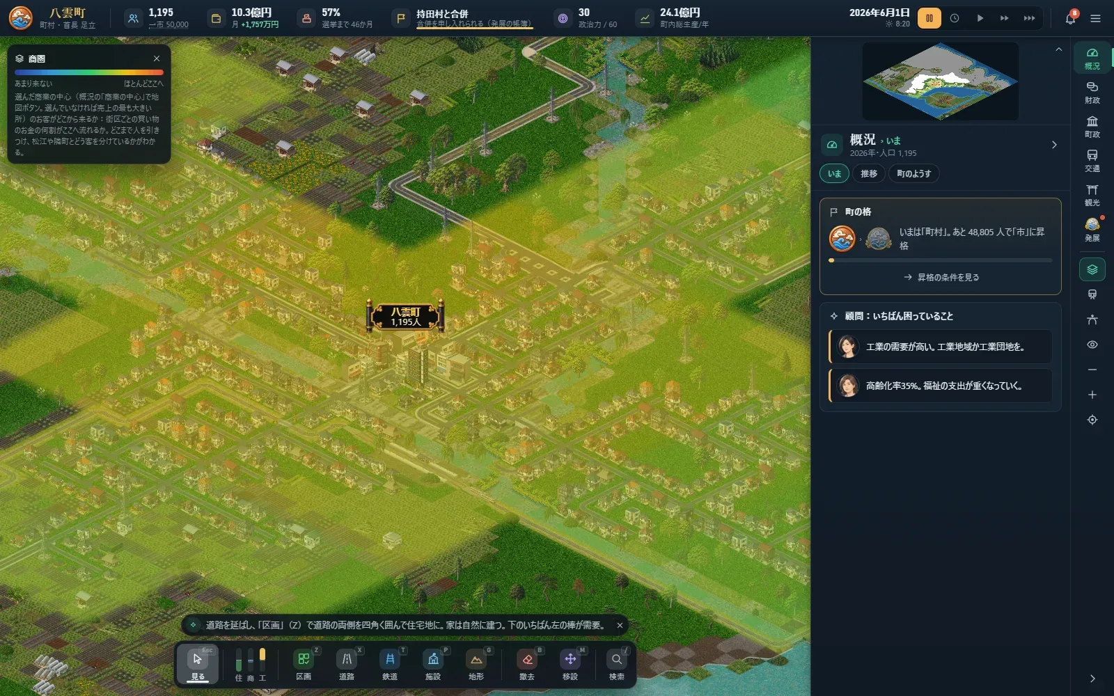
Matsue, Yonago and Izumo, beyond the edge of the map, became living cities with their own population and commuters. In a month when you're away on a trip, you can look around the city you're visiting: the Ohashi River, the castle and the prefectural office in Matsue, the castle ruins and Kaike hot springs in Yonago, the great shrine in Izumo, the dunes and Mount Kyusho in Tottori. Each landmark sits where it really is.
Day 12
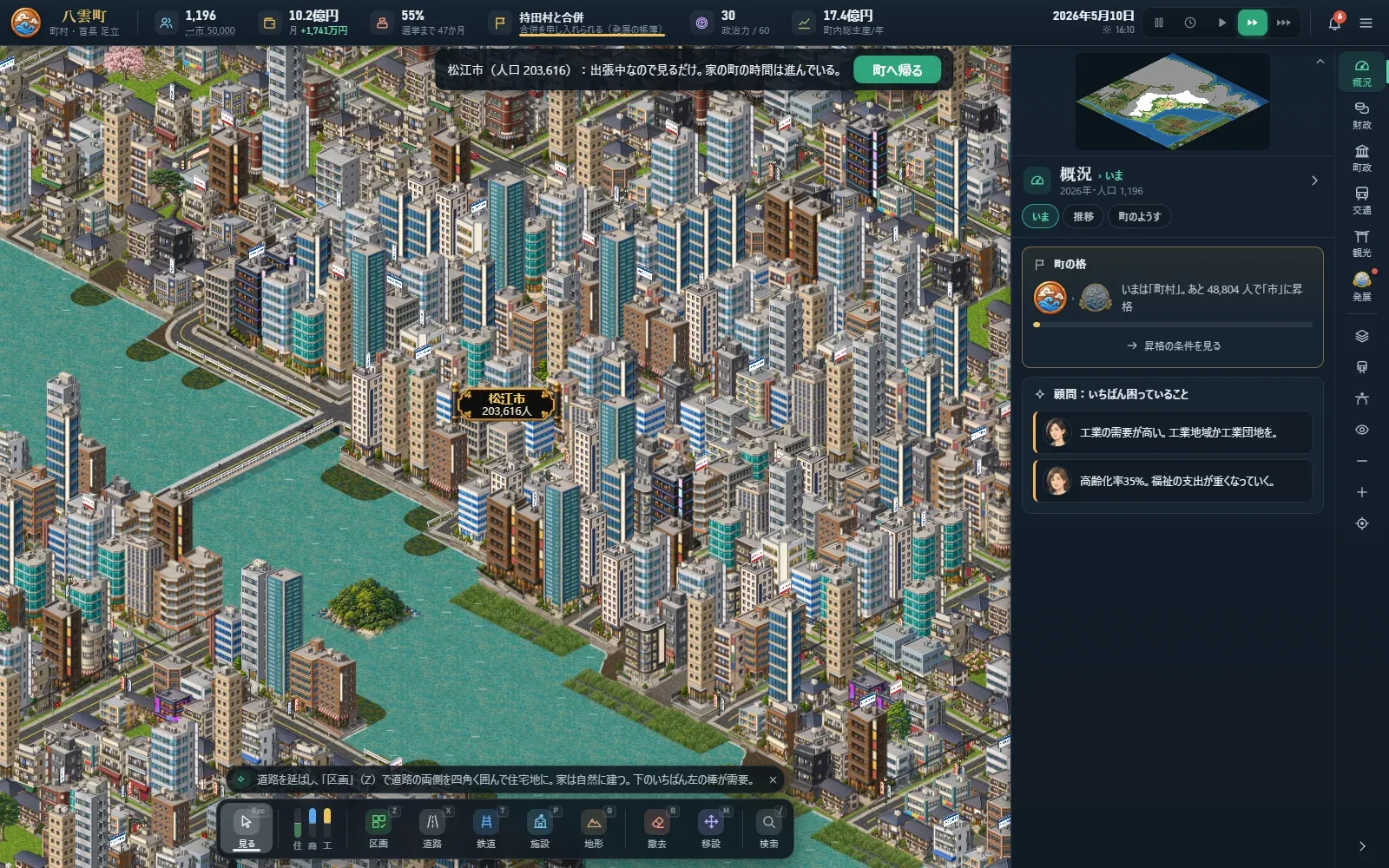
The nine departments of the town hall got section chiefs with names, personalities and skills. You choose one of four reasons you became mayor, and the petitions and the local paper's headlines come from what is really happening in town. The mayors next door make their own moves, true to character. In big disasters you can watch the tsunami run up the land and the river spill over, while ambulances and police cars are on the move. The controls were gathered on the right.
Day 11
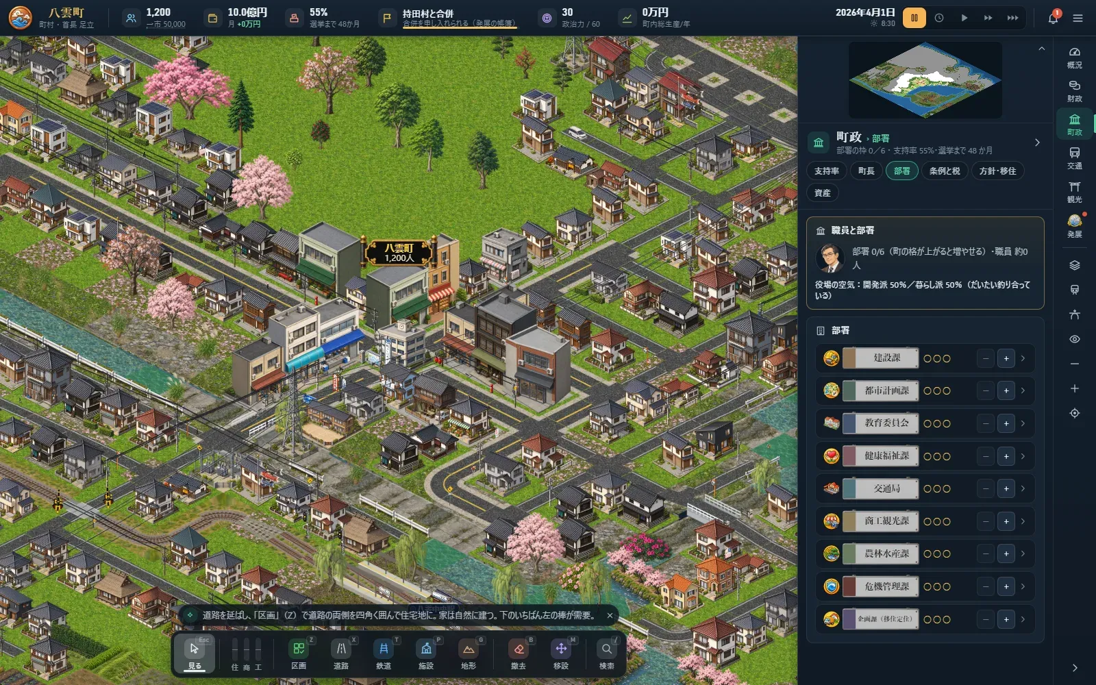
The screen was rebuilt with the building buttons in one row along the bottom, so more of the map shows. Population is now counted year by year from 0 to 100, with a population pyramid. A clock runs each month day by day: when a fire breaks out, the fire engine drives there along the roads, and the later it arrives, the further the fire spreads. When a siren comes near, cars stop and pull over.
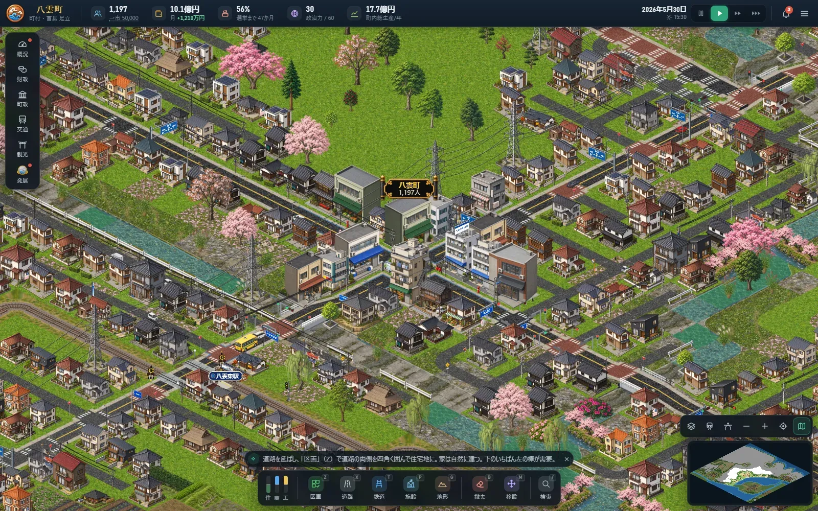
Day 10
A second currency, political capital, arrived, along with the fiscal soundness ratios and a year-end accounts card, city planning areas, the business cycle, negotiations to bring in companies, ageing public facilities and empty houses. The day before, the self-playing mayor used for testing had played all the way from a small town to the ending in year 145. At the very end you negotiate eight conditions with the national government.
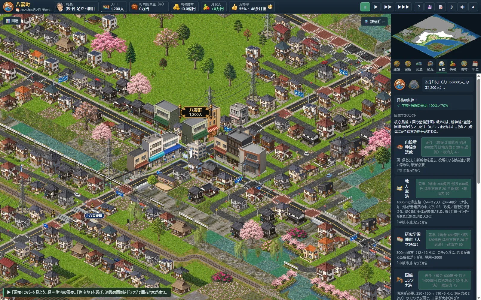
Day 6
Teaser Trailer 01 was made and this site went up. In the evening, the starting map was replaced with the real lie of the land at Honjo in Matsue, on Lake Nakaumi: hills to the north, the lake to the south, and the town starting on the narrow flat land between them.
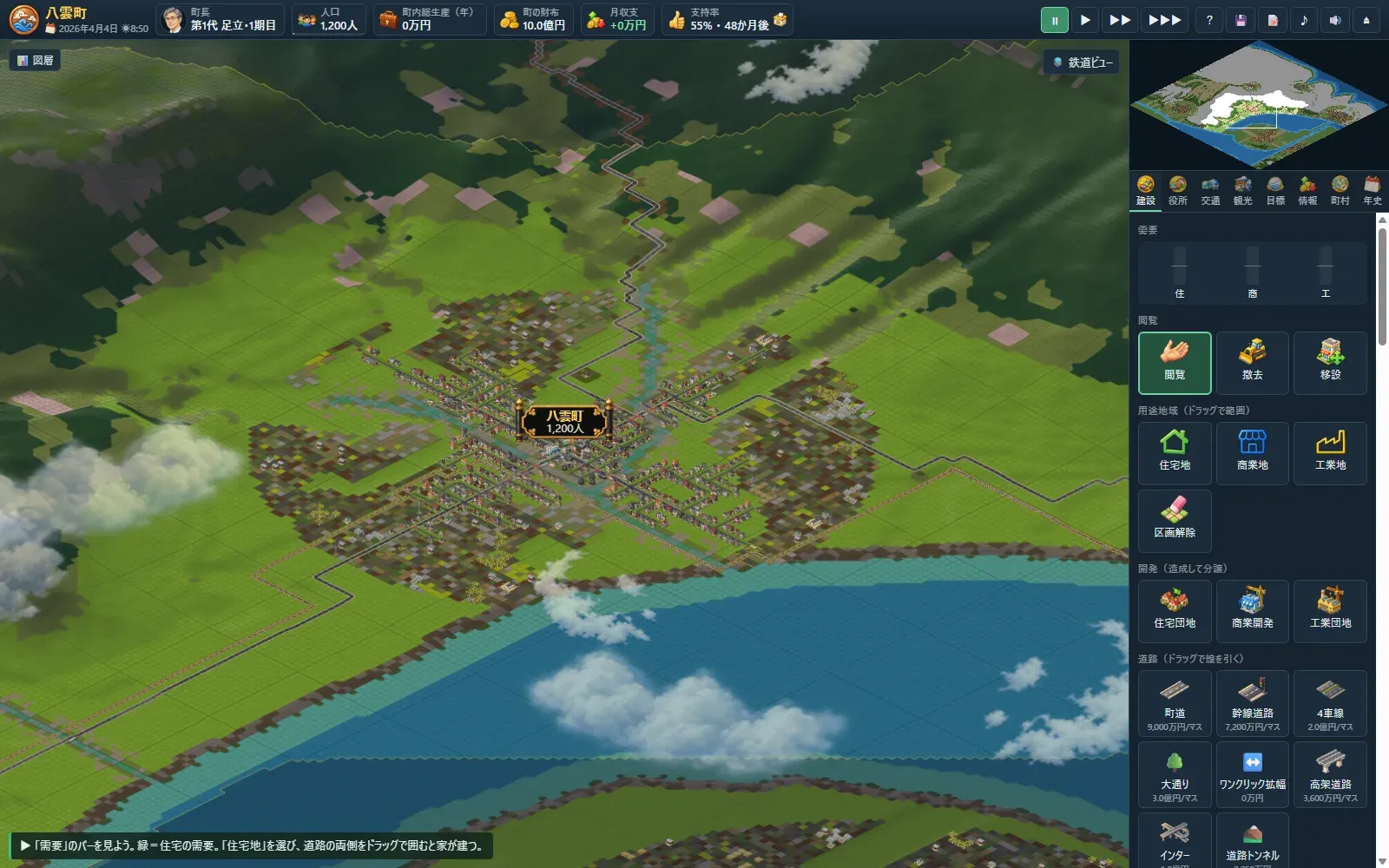
Day 5
Every piece of art drawn so far went into the game. The jagged grid disappeared from coasts, river banks and the edges of woods, and level crossings and traffic lights change shape with the width of the road and the number of tracks. Tunnels through the hills and buildings in six sizes date from this day too.
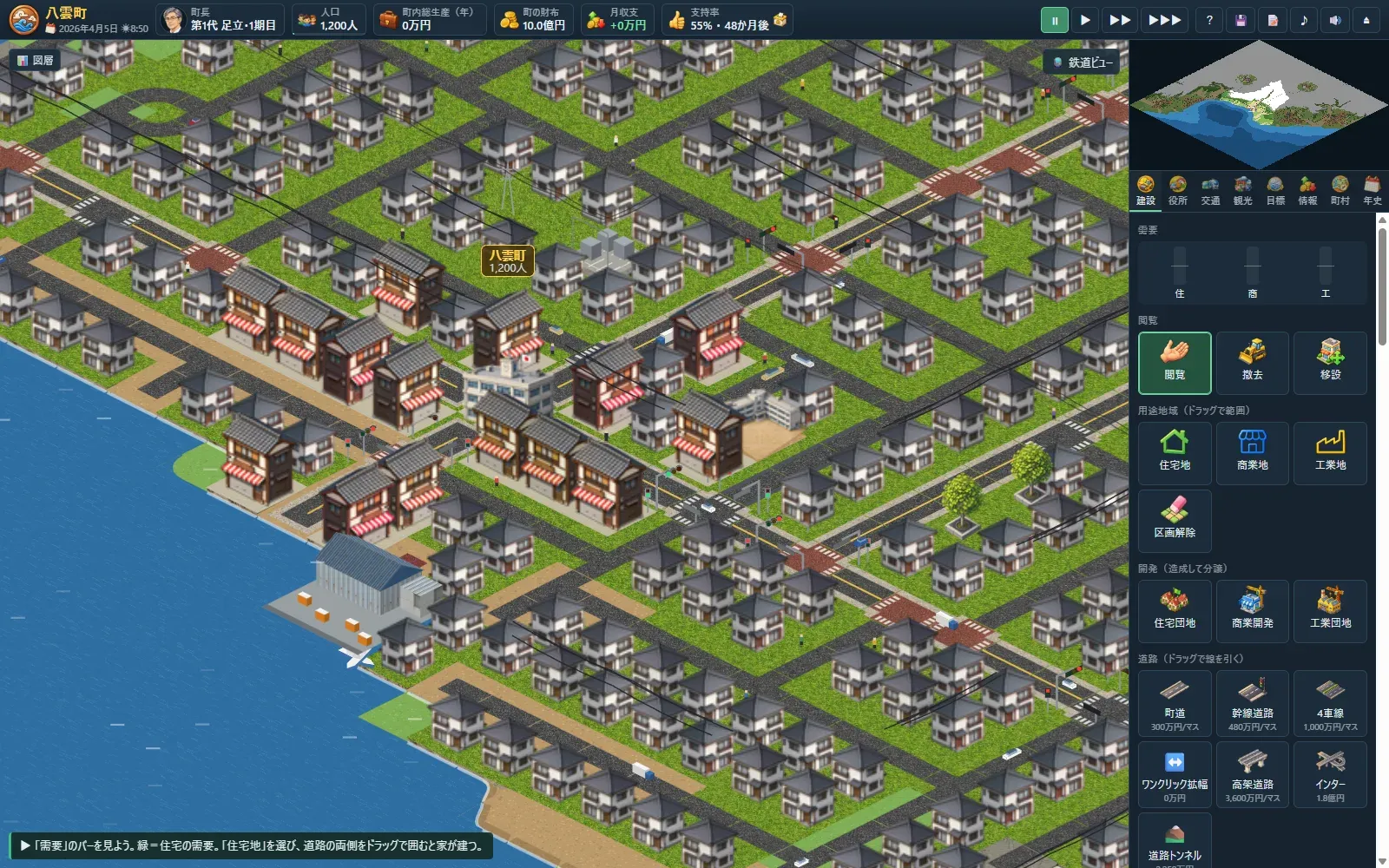
Day 4
The map grew to 512 tiles square (about 12.8 km) and the land was rebuilt with ranges of hills, basins, rivers, lakes and a brackish lagoon. Steep slopes can't be built on. Without water and power the town won't grow, and tsunamis, storm surges, floods and landslides now happen.
Day 3
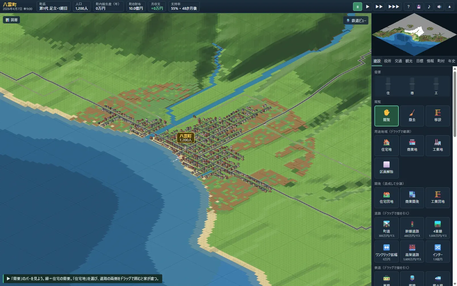
Track and stations could now be laid, and trains, cars, ships and planes started moving on screen. Cars stop at lights and level crossings, and people appear on foot. Chain stores, tourism, negotiations with JR, the subway and buses, day and night and the weather all came the same day.
Day 2
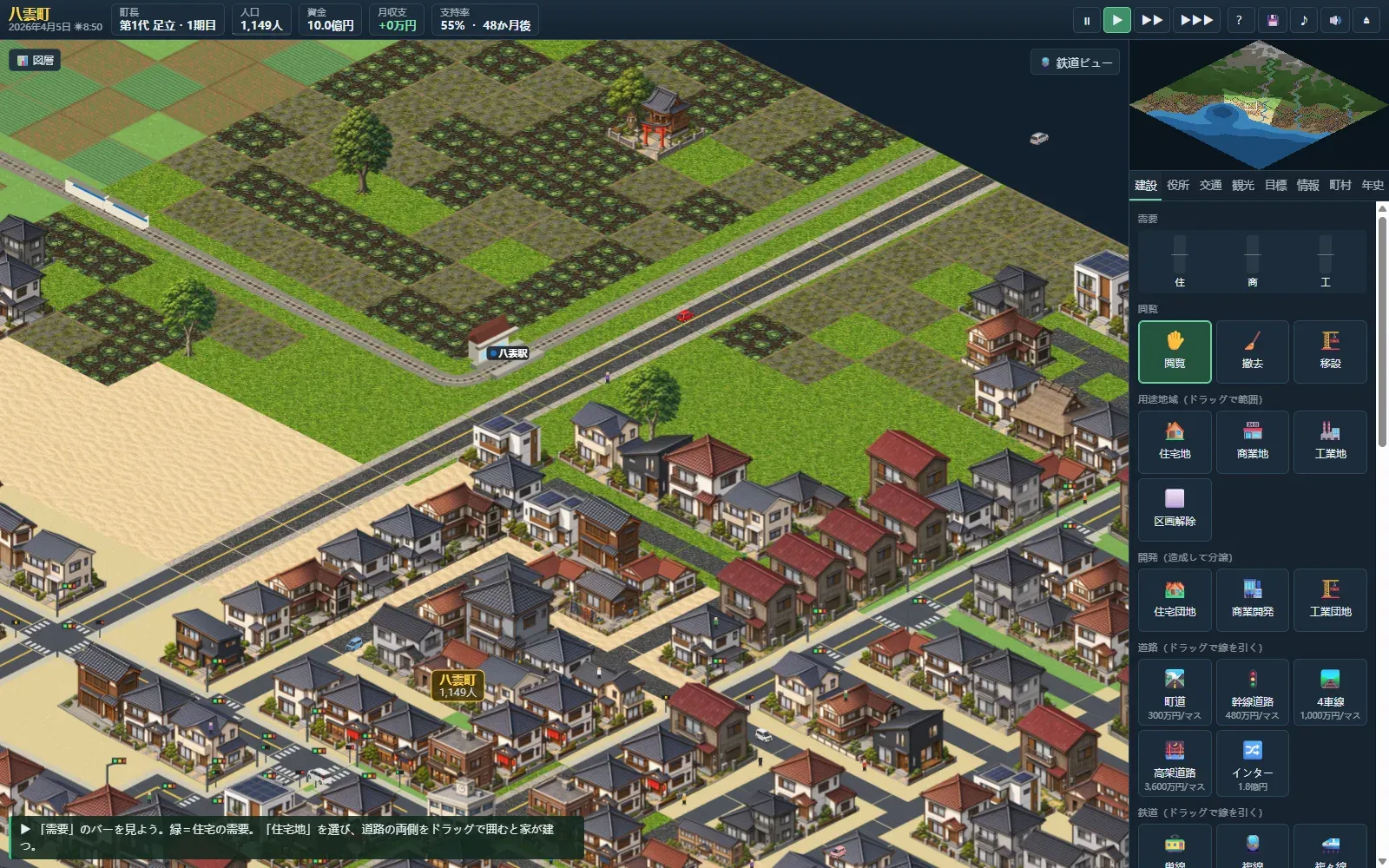
Just after midnight, a square prototype seen from straight above became playable, already with roads, homes and factories, mergers, elections, disasters and saving. By midday the view had turned to the angle from above, and by night the buildings drawn by gpt-image were in. A tile of about 25 metres, homes that build themselves once you draw the zones, local finance and town hall departments also date from this day.
Day 1
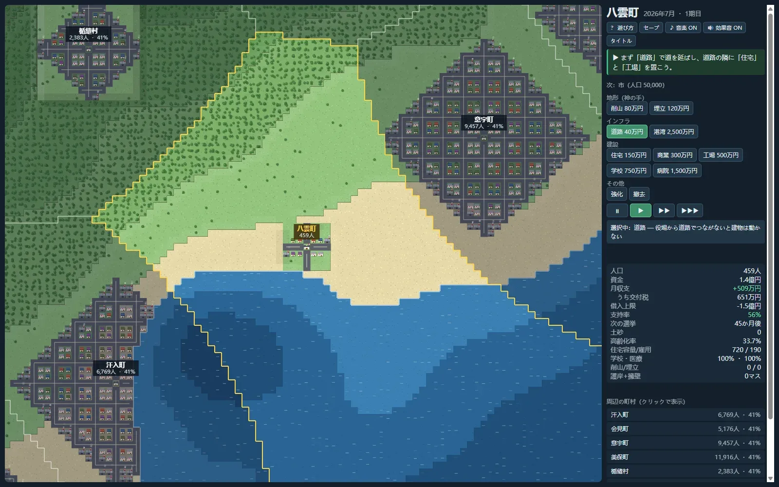
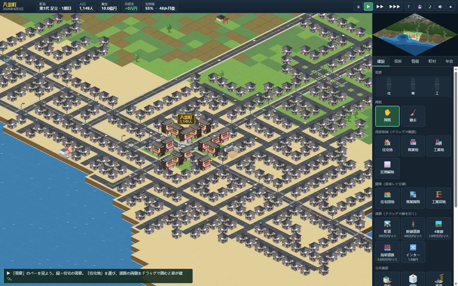
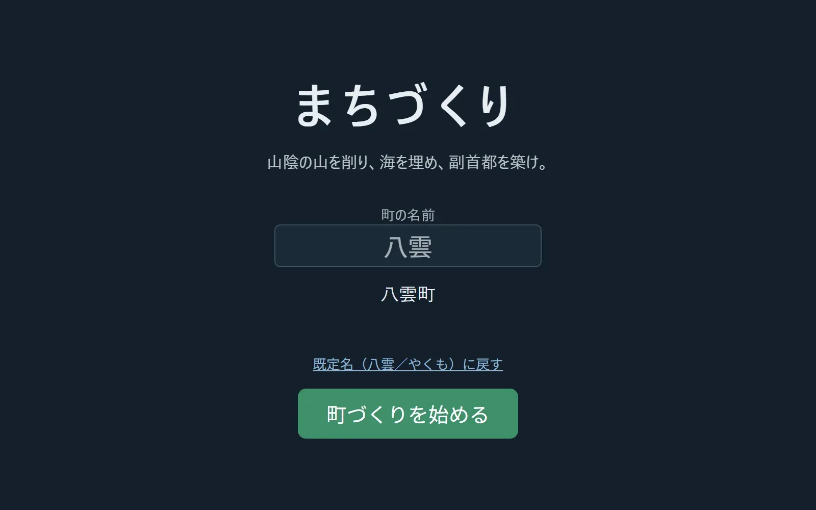
The groundwork of the program and a title screen for naming your town. The setting is San'in, and the town is called Yakumo. The very first line read "Level the hills of San'in, fill in the sea, build a second capital." No map yet, only words.
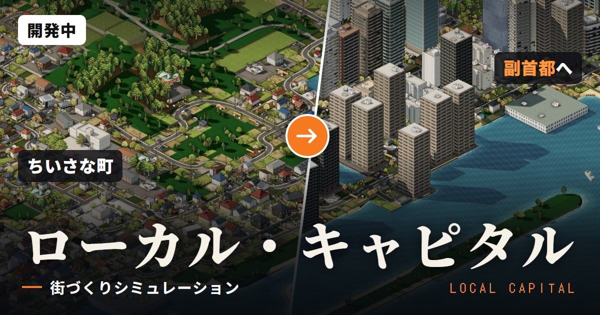
Post the link and it shows up as this card.